Dinas Powys night lights from space
Night Light of Dinas Powys (Wales) from space (United Kingdom) Src. Average luminocity for 10x10km area is 48.0548% and for 50x50km: 16.5175%.
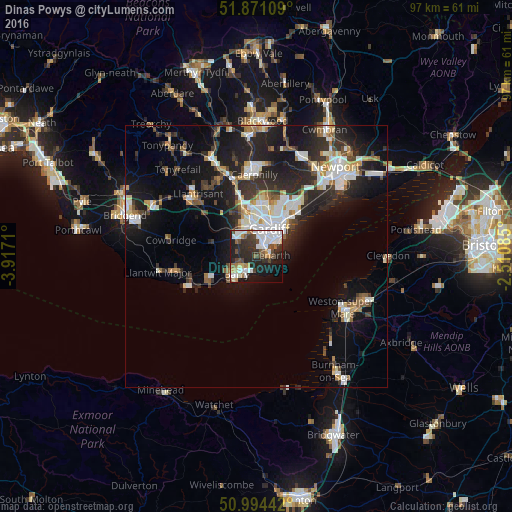
Analysis of Dinas Powys night lights 2016
Square area 10x10 km:
 13.1%
13.1%90-99
11.9%80-89
2.27%70-79
4.01%60-69
3.48%50-59
5.08%40-49
7.62%30-39
7.22%20-29
18.72%10-19
18.45%0-9
8.16%Square area 50x50 km:
3.06%90-99
3.5%80-89
1.19%70-79
1.55%60-69
1.53%50-59
1.56%40-49
1.88%30-39
2.61%20-29
6.54%10-19
11.89%0-9
64.69%Clear (daylight) street map image can be seen on geolist.org.
Map coordinates:
51° 52' 15.9" North, 3° 55' 1.6" West
51° 26' 5.5" North, 3° 12' 50.3" West
50° 59' 39.9" North, 2° 30' 39.1" West
Some cities around Dinas Powys sort by population:
• Cardiff
5.5 km =3.4 mi,  25°
25°
• Barry
6.2 km =3.9 mi,  231°
231°
• Caerphilly
15.5 km =9.6 mi,  358°
358°
• Penarth
2.8 km =1.7 mi,  81°
81°
• Llantrisant
16.1 km =10 mi,  316°
316°
• Beddau
16.6 km =10.3 mi, 323°
• Rhoose
11 km =6.8 mi,  241°
241°
• Pontyclun
15.6 km =9.7 mi,  308°
308°
2651248 (p: 7,738)
Sources (retrieved 2019-11-25):
» Earth at Night: Flat Maps 2012, 2016