Cardiff night lights from space
Night Light of Cardiff (Wales) from space (United Kingdom) Src. Average luminocity for 10x10km area is 75.615% and for 50x50km: 17.5669%.
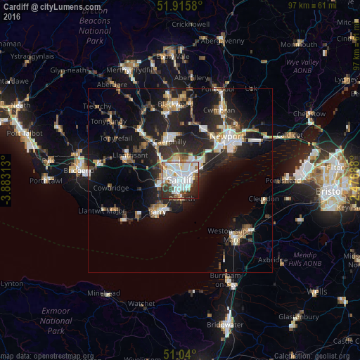
Analysis of Cardiff night lights 2016
Square area 10x10 km:
 28.34%
90-99
29.41%80-89
4.14%70-79
4.14%60-69
3.21%50-59
4.14%40-49
4.41%30-39
8.29%20-29
10.29%10-19
3.48%0-9
0.13%Square area 50x50 km:
2.97%90-99
3.55%80-89
1.25%70-79
1.83%60-69
1.67%50-59
1.88%40-49
2.16%30-39
2.74%20-29
6.79%10-19
13.07%0-9
62.09%Clear (daylight) street map image can be seen on geolist.org.
Map coordinates:
51° 54' 56.9" North, 3° 52' 59.3" West
51° 28' 48" North, 3° 10' 48" West
51° 2' 24" North, 2° 28' 36.8" West
Some cities around Cardiff sort by population:
• Barry
11.5 km =7.1 mi,  218°
218°
• Caerphilly
10.8 km =6.7 mi,  345°
345°
• Penarth
4.6 km =2.9 mi,  174°
174°
• Llantrisant
15 km =9.3 mi,  296°
296°
• Bedwas
12.5 km =7.8 mi, 354°
• Beddau
14.8 km =9.2 mi, 303°
• Dinas Powys
5.5 km =3.4 mi,  205°
205°
• Abertridwr
14.3 km =8.9 mi,  334°
334°
2653822 (p: 447,287)
Sources (retrieved 2019-11-25):
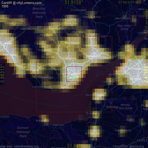
» NASA, Earths city lights 1995
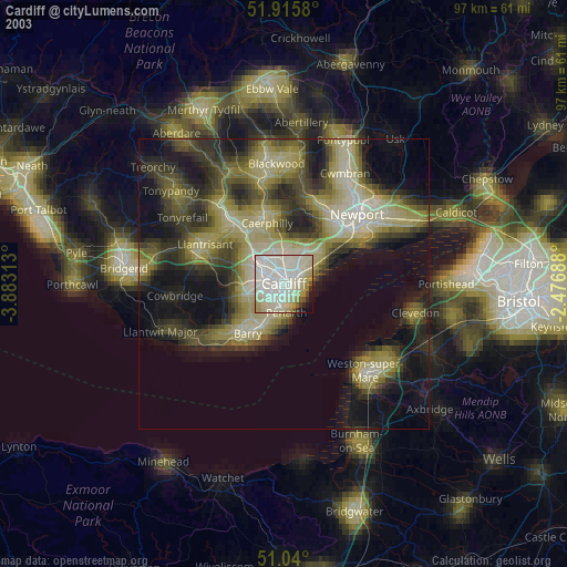
» NASA city lights 2003
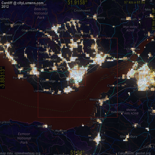
» Earth at Night: Flat Maps 2012, 2016