Wantage night lights from space
Night Light of Wantage (England) from space (United Kingdom) Src. Average luminocity for 10x10km area is 6.0602% and for 50x50km: 10.025%.
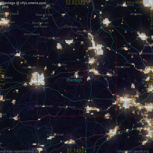
Analysis of Wantage night lights 2016
Square area 10x10 km:
 0.67%
0.67%90-99
0.4%80-89
0.13%70-79
0.4%60-69
2.27%50-59
1.07%40-49
1.47%30-39
0.94%20-29
1.2%10-19
0%0-9
91.44%Square area 50x50 km:
1.67%90-99
2.22%80-89
0.72%70-79
0.74%60-69
1.04%50-59
0.79%40-49
1.34%30-39
1.11%20-29
3.28%10-19
7.98%0-9
79.11%Clear (daylight) street map image can be seen on geolist.org.
Map coordinates:
52° 1' 23.6" North, 2° 7' 43.6" West
51° 35' 18.5" North, 1° 25' 32.3" West
51° 8' 58.2" North, 0° 43' 21.1" West
Some cities around Wantage sort by population:
• Abingdon
13.5 km =8.4 mi,  47°
47°
• Didcot
12.9 km =8 mi,  79°
79°
• Grove
2.4 km =1.5 mi,  6°
6°
• Wallingford
20.8 km =12.9 mi,  86°
86°
• Highworth
20.3 km =12.6 mi,  283°
283°
• Faringdon
13.4 km =8.3 mi,  304°
304°
• Hungerford
20.3 km =12.6 mi,  197°
197°
• West Ilsley
8.9 km =5.5 mi,  127°
127°
2634801 (p: 18,505)
Sources (retrieved 2019-11-25):
» Earth at Night: Flat Maps 2012, 2016