West Ilsley night lights from space
Night Light of West Ilsley (England) from space (United Kingdom) Src. Average luminocity for 10x10km area is 4.377% and for 50x50km: 8.6518%.
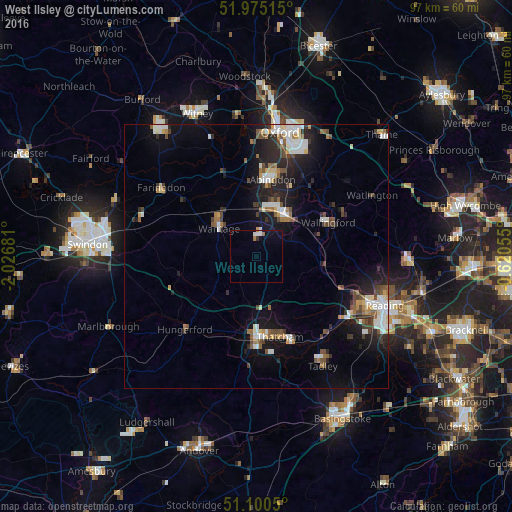
Analysis of West Ilsley night lights 2016
Square area 10x10 km:
 0.8%
0.8%90-99
1.07%80-89
0%70-79
0.27%60-69
1.07%50-59
0%40-49
0%30-39
0%20-29
0.53%10-19
2.54%0-9
93.72%Square area 50x50 km:
1.27%90-99
1.72%80-89
0.63%70-79
0.6%60-69
1.06%50-59
0.9%40-49
1.5%30-39
1.12%20-29
2.51%10-19
6.18%0-9
82.51%Clear (daylight) street map image can be seen on geolist.org.
Map coordinates:
51° 58' 30.5" North, 2° 1' 36.5" West
51° 32' 23.7" North, 1° 19' 25.2" West
51° 6' 1.8" North, 0° 37' 14" West
Some cities around West Ilsley sort by population:
• Abingdon
14.9 km =9.3 mi,  10°
10°
• Newbury
15.4 km =9.6 mi,  180°
180°
• Didcot
9.6 km =6 mi,  36°
36°
• Thatcham
15.8 km =9.8 mi,  163°
163°
• Wantage
8.9 km =5.5 mi,  307°
307°
• Grove
10.3 km =6.4 mi,  318°
318°
• Wallingford
15.3 km =9.5 mi,  64°
64°
• Benson
17.3 km =10.7 mi, 58°
11747336 (p: 332)
Sources (retrieved 2019-11-25):
» Earth at Night: Flat Maps 2012, 2016