Undy night lights from space
Night Light of Undy (Wales) from space (United Kingdom) Src. Average luminocity for 10x10km area is 15.885% and for 50x50km: 18.5829%.
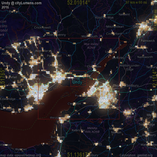
Analysis of Undy night lights 2016
Square area 10x10 km:
 1.6%
1.6%90-99
2.67%80-89
0.94%70-79
3.07%60-69
1.87%50-59
2.27%40-49
0.94%30-39
0.27%20-29
1.74%10-19
8.96%0-9
75.67%Square area 50x50 km:
3.55%90-99
3.98%80-89
1.64%70-79
1.8%60-69
1.65%50-59
2.44%40-49
1.92%30-39
2.38%20-29
6.4%10-19
12.07%0-9
62.18%Clear (daylight) street map image can be seen on geolist.org.
Map coordinates:
52° 0' 36.5" North, 3° 31' 3.5" West
51° 34' 30.9" North, 2° 48' 52.3" West
51° 8' 10.2" North, 2° 6' 41" West
Some cities around Undy sort by population:
• Newport
12.8 km =8 mi,  276°
276°
• Portishead
10.8 km =6.7 mi,  163°
163°
• Clevedon
15.1 km =9.4 mi,  191°
191°
• Nailsea
16.4 km =10.2 mi,  166°
166°
• Chepstow
12 km =7.5 mi,  52°
52°
• Caldicot
4.1 km =2.5 mi,  72°
72°
• Caerleon
10.3 km =6.4 mi,  291°
291°
• Magor
1.3 km =0.8 mi, 291°
2635174 (p: 5,914)
Sources (retrieved 2019-11-25):
» Earth at Night: Flat Maps 2012, 2016