Magor night lights from space
Night Light of Magor (Wales) from space (United Kingdom) Src. Average luminocity for 10x10km area is 16.8422% and for 50x50km: 19.3271%.
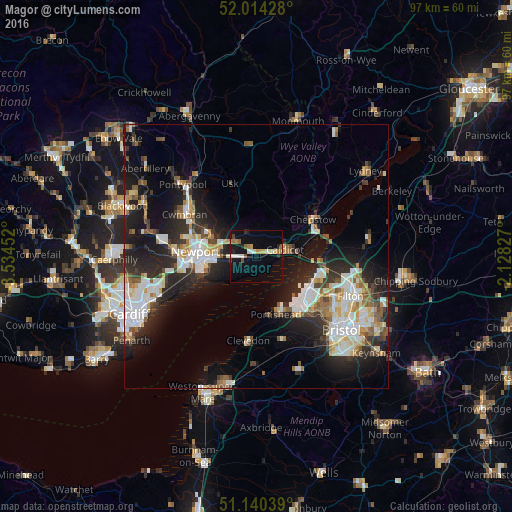
Analysis of Magor night lights 2016
Square area 10x10 km:
 2.14%
2.14%90-99
3.21%80-89
0.94%70-79
2.41%60-69
1.6%50-59
2.14%40-49
1.47%30-39
0.67%20-29
1.87%10-19
12.57%0-9
70.99%Square area 50x50 km:
3.75%90-99
4.23%80-89
1.69%70-79
1.9%60-69
1.76%50-59
2.48%40-49
1.92%30-39
2.41%20-29
6.69%10-19
12.22%0-9
60.94%Clear (daylight) street map image can be seen on geolist.org.
Map coordinates:
52° 0' 51.4" North, 3° 32' 4.3" West
51° 34' 46" North, 2° 49' 53" West
51° 8' 25.4" North, 2° 7' 41.8" West
Some cities around Magor sort by population:
• Newport
11.6 km =7.2 mi,  274°
274°
• Cwmbran
15.6 km =9.7 mi,  302°
302°
• Portishead
11.6 km =7.2 mi,  158°
158°
• Clevedon
15.4 km =9.6 mi,  186°
186°
• Chepstow
12.7 km =7.9 mi,  57°
57°
• Caldicot
5.2 km =3.2 mi,  81°
81°
• Caerleon
9.1 km =5.7 mi,  291°
291°
• Undy
1.3 km =0.8 mi,  111°
111°
2643196 (p: 5,941)
Sources (retrieved 2019-11-25):
» Earth at Night: Flat Maps 2012, 2016