Oldbury night lights from space
Night Light of Oldbury (England) from space (United Kingdom) Src. Average luminocity for 10x10km area is 96.4312% and for 50x50km: 40.7932%.
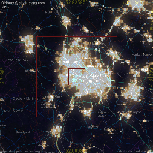
Analysis of Oldbury night lights 2016
Square area 10x10 km:
 44.05%
90-99
41.93%80-89
9.92%70-79
3.17%60-69
0.93%50-59
0%40-49
0%30-39
0%20-29
0%10-19
0%0-9
0%Square area 50x50 km:
12.86%90-99
10.87%80-89
3.45%70-79
3.63%60-69
3.81%50-59
3.21%40-49
3.78%30-39
3.71%20-29
8.09%10-19
13.56%0-9
33.03%Clear (daylight) street map image can be seen on geolist.org.
Map coordinates:
52° 55' 33.4" North, 2° 43' 11.3" West
52° 30' 0" North, 2° 1' 0" West
52° 4' 11.6" North, 1° 18' 48.8" West
Some cities around Oldbury sort by population:
• Dudley
4.5 km =2.8 mi,  270°
270°
• West Bromwich
2.6 km =1.6 mi,  35°
35°
• Halesowen
6.1 km =3.8 mi,  201°
201°
• Tipton
4.8 km =3 mi,  313°
313°
• Wednesbury
5.7 km =3.5 mi,  355°
355°
• Hockley
6.8 km =4.2 mi,  90°
90°
• Smethwick
3.4 km =2.1 mi,  103°
103°
• Cradley Heath
5.4 km =3.4 mi,  235°
235°
2641036 (p: 10,830)
Sources (retrieved 2019-11-25):
» Earth at Night: Flat Maps 2012, 2016