West Bromwich night lights from space
Night Light of West Bromwich (England) from space (United Kingdom) Src. Average luminocity for 10x10km area is 96.5516% and for 50x50km: 40.9968%.
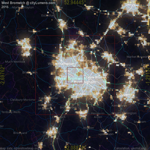
Analysis of West Bromwich night lights 2016
Square area 10x10 km:
 47.62%
90-99
38.62%80-89
9.92%70-79
2.91%60-69
0.93%50-59
0%40-49
0%30-39
0%20-29
0%10-19
0%0-9
0%Square area 50x50 km:
12.84%90-99
10.82%80-89
3.41%70-79
3.58%60-69
3.84%50-59
3.22%40-49
3.79%30-39
3.78%20-29
8.2%10-19
14.96%0-9
31.55%Clear (daylight) street map image can be seen on geolist.org.
Map coordinates:
52° 56' 40" North, 2° 41' 51.4" West
52° 31' 7.2" North, 1° 59' 40.2" West
52° 5' 19.5" North, 1° 17' 28.9" West
Some cities around West Bromwich sort by population:
• Birmingham
7.6 km =4.7 mi,  122°
122°
• Dudley
6.4 km =4 mi,  250°
250°
• Walsall
7.4 km =4.6 mi,  5°
5°
• Tipton
5.1 km =3.2 mi,  283°
283°
• Wednesbury
4.1 km =2.5 mi,  331°
331°
• Hockley
5.7 km =3.5 mi,  111°
111°
• Smethwick
3.4 km =2.1 mi,  147°
147°
• Oldbury
2.6 km =1.6 mi,  215°
215°
2634491 (p: 135,618)
Sources (retrieved 2019-11-25):
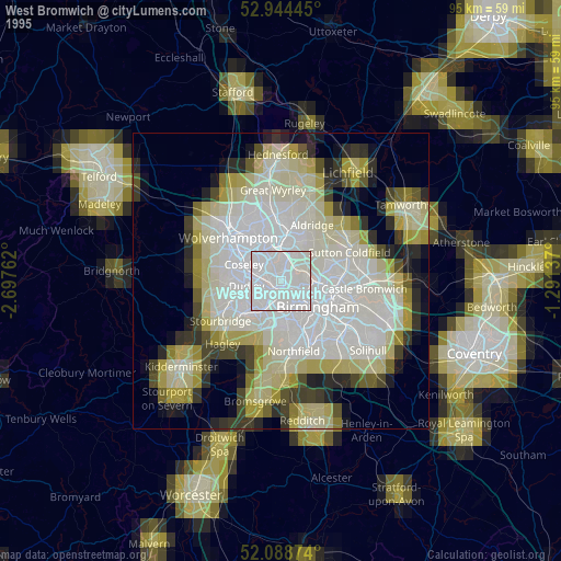
» NASA, Earths city lights 1995
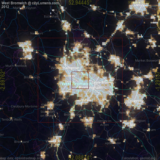
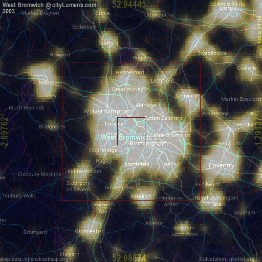
» NASA city lights 2003
» Earth at Night: Flat Maps 2012, 2016