Tetbury night lights from space
Night Light of Tetbury (England) from space (United Kingdom) Src. Average luminocity for 10x10km area is 0.9286% and for 50x50km: 6.9386%.
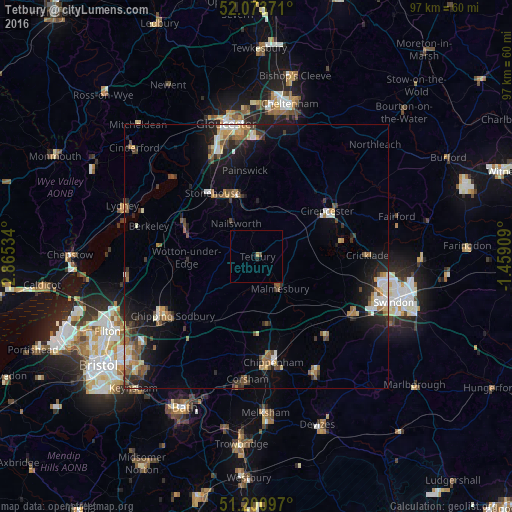
Analysis of Tetbury night lights 2016
Square area 10x10 km:
 0%
0%90-99
0%80-89
0%70-79
0.42%60-69
0.14%50-59
0%40-49
0.56%30-39
0%20-29
0.42%10-19
0.28%0-9
98.18%Square area 50x50 km:
0.63%90-99
0.95%80-89
0.62%70-79
0.76%60-69
1.11%50-59
1.2%40-49
1.17%30-39
1.02%20-29
1.72%10-19
5.05%0-9
85.78%Clear (daylight) street map image can be seen on geolist.org.
Map coordinates:
52° 4' 25.4" North, 2° 51' 55.2" West
51° 38' 22" North, 2° 9' 44" West
51° 12' 3.5" North, 1° 27' 32.7" West
Some cities around Tetbury sort by population:
• Stroud
12.6 km =7.8 mi,  348°
348°
• Cirencester
15.9 km =9.9 mi,  55°
55°
• Dursley
14 km =8.7 mi,  289°
289°
• Stonehouse
14.9 km =9.3 mi,  325°
325°
• Chalford
9.6 km =6 mi,  4°
4°
• Malmesbury
7.8 km =4.8 mi,  144°
144°
• Wotton-under-Edge
12.6 km =7.8 mi,  266°
266°
• Nailsworth
7.2 km =4.5 mi, 326°
2636083 (p: 5,472)
Sources (retrieved 2019-11-25):
» Earth at Night: Flat Maps 2012, 2016