Cirencester night lights from space
Night Light of Cirencester (England) from space (United Kingdom) Src. Average luminocity for 10x10km area is 7.7759% and for 50x50km: 8.5788%.
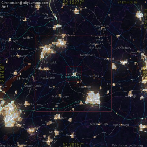
Analysis of Cirencester night lights 2016
Square area 10x10 km:
 1.4%
1.4%90-99
1.96%80-89
0%70-79
1.12%60-69
0.56%50-59
0%40-49
1.12%30-39
1.68%20-29
0.56%10-19
1.68%0-9
89.92%Square area 50x50 km:
1.4%90-99
1.65%80-89
0.7%70-79
0.93%60-69
1.04%50-59
0.81%40-49
0.99%30-39
0.9%20-29
2.54%10-19
7.3%0-9
81.74%Clear (daylight) street map image can be seen on geolist.org.
Map coordinates:
52° 9' 10" North, 2° 40' 28.5" West
51° 43' 9.4" North, 1° 58' 17.2" West
51° 16' 53.7" North, 1° 16' 6" West
Some cities around Cirencester sort by population:
• Stroud
16.1 km =10 mi,  282°
282°
• Charlton Kings
18.9 km =11.7 mi,  345°
345°
• Royal Wootton Bassett
20.3 km =12.6 mi,  166°
166°
• Highworth
20.5 km =12.7 mi,  118°
118°
• Chalford
12.4 km =7.7 mi,  273°
273°
• Malmesbury
17.6 km =10.9 mi,  209°
209°
• Tetbury
15.9 km =9.9 mi,  235°
235°
• Nailsworth
17.4 km =10.8 mi,  260°
260°
2652995 (p: 17,153)
Sources (retrieved 2019-11-25):
» Earth at Night: Flat Maps 2012, 2016