Chalford night lights from space
Night Light of Chalford (England) from space (United Kingdom) Src. Average luminocity for 10x10km area is 2.3711% and for 50x50km: 7.4988%.
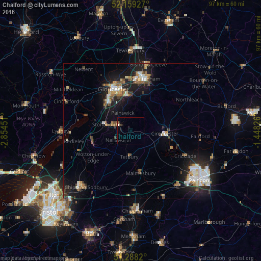
Analysis of Chalford night lights 2016
Square area 10x10 km:
 0.14%
0.14%90-99
0.42%80-89
0%70-79
0%60-69
0.56%50-59
0.56%40-49
0%30-39
0.56%20-29
0.7%10-19
1.54%0-9
95.52%Square area 50x50 km:
0.85%90-99
1.22%80-89
0.68%70-79
0.92%60-69
1.08%50-59
0.91%40-49
1.04%30-39
0.92%20-29
2.11%10-19
6.69%0-9
83.59%Clear (daylight) street map image can be seen on geolist.org.
Map coordinates:
52° 9' 33.4" North, 2° 51' 16.2" West
51° 43' 33" North, 2° 9' 5" West
51° 17' 17.5" North, 1° 26' 53.7" West
Some cities around Chalford sort by population:
• Gloucester
16.8 km =10.4 mi,  337°
337°
• Stroud
4.3 km =2.7 mi,  308°
308°
• Cirencester
12.4 km =7.7 mi,  93°
93°
• Dursley
14.8 km =9.2 mi,  250°
250°
• Stonehouse
9.5 km =5.9 mi,  286°
286°
• Malmesbury
16.5 km =10.3 mi,  166°
166°
• Tetbury
9.6 km =6 mi,  184°
184°
• Nailsworth
5.9 km =3.7 mi,  232°
232°
2653392 (p: 6,776)
Sources (retrieved 2019-11-25):
» Earth at Night: Flat Maps 2012, 2016