Tamworth night lights from space
Night Light of Tamworth (England) from space (United Kingdom) Src. Average luminocity for 10x10km area is 40.8426% and for 50x50km: 37.8988%.
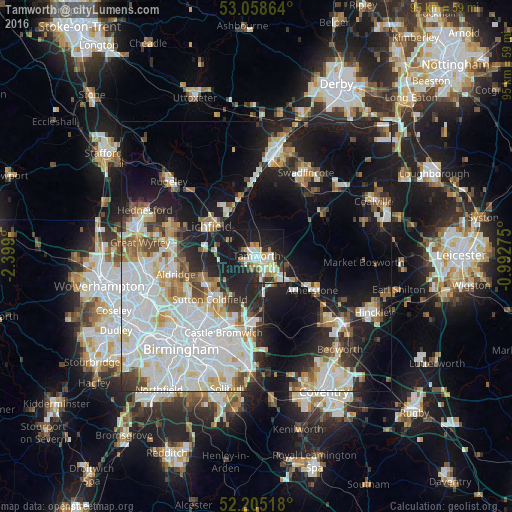
Analysis of Tamworth night lights 2016
Square area 10x10 km:
 6.61%
6.61%90-99
11.24%80-89
4.5%70-79
5.82%60-69
4.63%50-59
1.06%40-49
1.59%30-39
4.63%20-29
13.49%10-19
42.86%0-9
3.57%Square area 50x50 km:
11.39%90-99
9.89%80-89
3.36%70-79
3.08%60-69
3.21%50-59
2.98%40-49
3.23%30-39
2.96%20-29
7.68%10-19
19.11%0-9
33.12%Clear (daylight) street map image can be seen on geolist.org.
Map coordinates:
53° 3' 31.1" North, 2° 23' 56.4" West
52° 38' 2.4" North, 1° 41' 45.1" West
52° 12' 18.6" North, 0° 59' 33.9" West
Some cities around Tamworth sort by population:
• Sutton Coldfield
11.1 km =6.9 mi,  227°
227°
• Lichfield
10.2 km =6.3 mi,  301°
301°
• Streetly
13.9 km =8.6 mi,  246°
246°
• Atherstone
12 km =7.5 mi,  122°
122°
• Castle Vale
14.5 km =9 mi,  208°
208°
• Polesworth
6 km =3.7 mi,  105°
105°
• Fazeley
2.2 km =1.4 mi,  184°
184°
• Measham
15.1 km =9.4 mi,  57°
57°
2636276 (p: 81,964)
Sources (retrieved 2019-11-25):
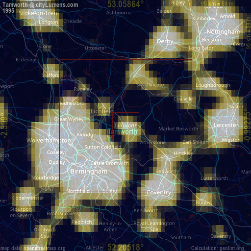
» NASA, Earths city lights 1995
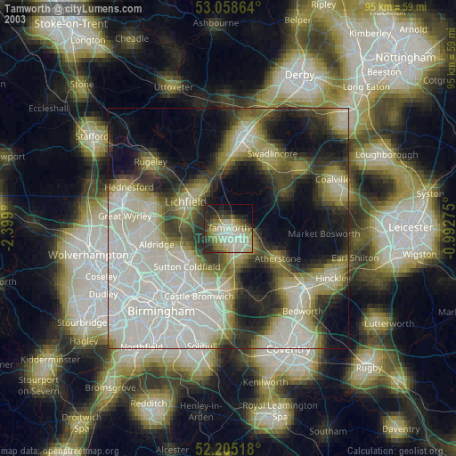
» NASA city lights 2003
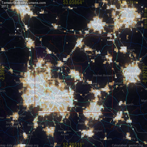
» Earth at Night: Flat Maps 2012, 2016