Castle Vale night lights from space
Night Light of Castle Vale (England) from space (United Kingdom) Src. Average luminocity for 10x10km area is 87.4815% and for 50x50km: 45.6277%.
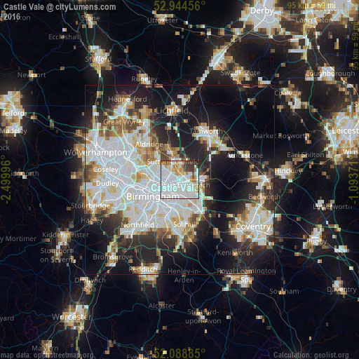
Analysis of Castle Vale night lights 2016
Square area 10x10 km:
 43.39%
90-99
25.53%80-89
7.54%70-79
6.75%60-69
4.89%50-59
1.98%40-49
2.65%30-39
5.29%20-29
1.98%10-19
0%0-9
0%Square area 50x50 km:
14.04%90-99
12.24%80-89
3.97%70-79
3.9%60-69
4.1%50-59
3.53%40-49
3.83%30-39
4.37%20-29
9.76%10-19
17.73%0-9
22.53%Clear (daylight) street map image can be seen on geolist.org.
Map coordinates:
52° 56' 40.4" North, 2° 29' 59.9" West
52° 31' 7.6" North, 1° 47' 48.6" West
52° 5' 19.9" North, 1° 5' 37.4" West
Some cities around Castle Vale sort by population:
• Birmingham
8.1 km =5 mi,  239°
239°
• Sutton Coldfield
5.5 km =3.4 mi,  345°
345°
• Washwood Heath
2.9 km =1.8 mi,  224°
224°
• Aston
6.2 km =3.9 mi,  250°
250°
• Acocks Green
7.8 km =4.8 mi,  189°
189°
• Hockley
8.4 km =5.2 mi,  255°
255°
• Streetly
9.3 km =5.8 mi,  320°
320°
• Chelmsley Wood
6 km =3.7 mi,  138°
138°
11778104 (p: 10,000)
Sources (retrieved 2019-11-25):
» Earth at Night: Flat Maps 2012, 2016