Sutton in Ashfield night lights from space
Night Light of Sutton in Ashfield (England) from space (United Kingdom) Src. Average luminocity for 10x10km area is 60.0013% and for 50x50km: 26.6702%.
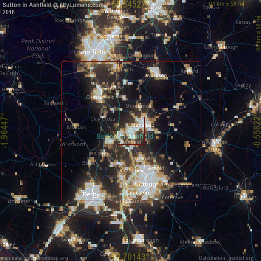
Analysis of Sutton in Ashfield night lights 2016
Square area 10x10 km:
 15.48%
90-99
16.8%80-89
4.37%70-79
5.82%60-69
6.48%50-59
4.63%40-49
4.63%30-39
17.33%20-29
18.25%10-19
6.22%0-9
0%Square area 50x50 km:
4.84%90-99
5.35%80-89
2.67%70-79
2.43%60-69
3.35%50-59
3.64%40-49
3.37%30-39
4.69%20-29
9.43%10-19
14.07%0-9
46.16%Clear (daylight) street map image can be seen on geolist.org.
Map coordinates:
53° 32' 43" North, 1° 57' 52.1" West
53° 7' 31.5" North, 1° 15' 40.9" West
52° 42' 5.1" North, 0° 33' 29.6" West
Some cities around Sutton in Ashfield sort by population:
• Mansfield
4.2 km =2.6 mi,  77°
77°
• Kirkby in Ashfield
3.1 km =1.9 mi,  157°
157°
• Alfreton
8.7 km =5.4 mi,  249°
249°
• Mansfield Woodhouse
6.3 km =3.9 mi,  45°
45°
• Pinxton
5.4 km =3.4 mi,  224°
224°
• Shirebrook
9.2 km =5.7 mi,  20°
20°
• Rainworth
9.6 km =6 mi,  94°
94°
• Ravenshead
8 km =5 mi,  122°
122°
2636484 (p: 43,912)
Sources (retrieved 2019-11-25):
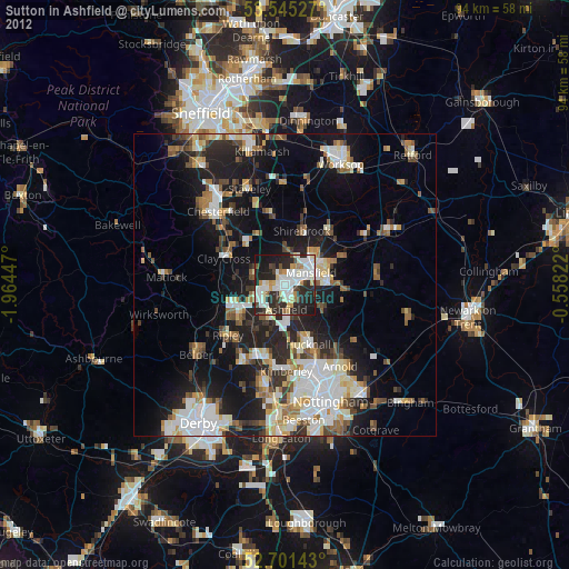
» Earth at Night: Flat Maps 2012, 2016