Rainworth night lights from space
Night Light of Rainworth (England) from space (United Kingdom) Src. Average luminocity for 10x10km area is 28.8651% and for 50x50km: 26.5359%.
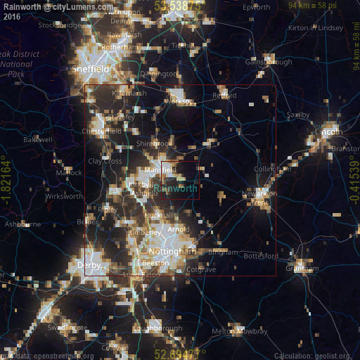
Analysis of Rainworth night lights 2016
Square area 10x10 km:
 3.97%
3.97%90-99
6.08%80-89
3.97%70-79
2.65%60-69
3.57%50-59
2.78%40-49
2.91%30-39
2.78%20-29
12.3%10-19
20.37%0-9
38.62%Square area 50x50 km:
4.83%90-99
5.31%80-89
2.54%70-79
2.52%60-69
3.32%50-59
3.56%40-49
3.44%30-39
4.82%20-29
9.29%10-19
13.98%0-9
46.39%Clear (daylight) street map image can be seen on geolist.org.
Map coordinates:
53° 32' 19.5" North, 1° 49' 17.9" West
53° 7' 7.8" North, 1° 7' 6.7" West
52° 41' 41.2" North, 0° 24' 55.4" West
Some cities around Rainworth sort by population:
• Mansfield
5.7 km =3.5 mi,  286°
286°
• Sutton in Ashfield
9.6 km =6 mi,  274°
274°
• Kirkby in Ashfield
8.6 km =5.3 mi,  255°
255°
• Mansfield Woodhouse
7.2 km =4.5 mi,  315°
315°
• Market Warsop
9.9 km =6.2 mi,  346°
346°
• Calverton
9.4 km =5.8 mi,  165°
165°
• Ravenshead
4.5 km =2.8 mi,  217°
217°
• Edwinstowe
9.2 km =5.7 mi,  23°
23°
2639687 (p: 7,693)
Sources (retrieved 2019-11-25):
» Earth at Night: Flat Maps 2012, 2016