Pinxton night lights from space
Night Light of Pinxton (England) from space (United Kingdom) Src. Average luminocity for 10x10km area is 54.1693% and for 50x50km: 27.0389%.
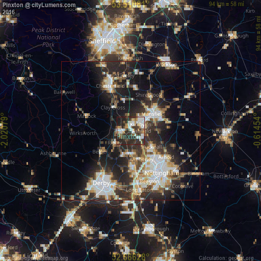
Analysis of Pinxton night lights 2016
Square area 10x10 km:
 12.57%
90-99
12.83%80-89
4.23%70-79
3.84%60-69
5.95%50-59
6.08%40-49
7.14%30-39
14.95%20-29
25.53%10-19
6.88%0-9
0%Square area 50x50 km:
4.97%90-99
5.49%80-89
2.68%70-79
2.5%60-69
3.2%50-59
3.35%40-49
3.51%30-39
4.94%20-29
10.46%10-19
14.01%0-9
44.89%Clear (daylight) street map image can be seen on geolist.org.
Map coordinates:
53° 30' 38.9" North, 2° 1' 14.8" West
53° 5' 26.2" North, 1° 19' 3.6" West
52° 39' 58.6" North, 0° 36' 52.3" West
Some cities around Pinxton sort by population:
• Mansfield
9.2 km =5.7 mi,  58°
58°
• Sutton in Ashfield
5.4 km =3.4 mi,  44°
44°
• Hucknall
10.1 km =6.3 mi,  129°
129°
• Kirkby in Ashfield
5 km =3.1 mi,  78°
78°
• Heanor
8.9 km =5.5 mi,  195°
195°
• Alfreton
4.5 km =2.8 mi,  280°
280°
• Ripley
8.4 km =5.2 mi,  220°
220°
• Eastwood
10.1 km =6.3 mi,  173°
173°
2640273 (p: 14,357)
Sources (retrieved 2019-11-25):
» Earth at Night: Flat Maps 2012, 2016