Churchdown night lights from space
Night Light of Churchdown (England) from space (United Kingdom) Src. Average luminocity for 10x10km area is 40.6351% and for 50x50km: 6.2471%.
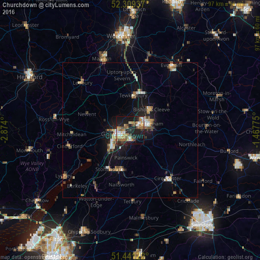
Analysis of Churchdown night lights 2016
Square area 10x10 km:
 4.55%
4.55%90-99
5.93%80-89
5.05%70-79
7.2%60-69
7.58%50-59
6.06%40-49
6.19%30-39
4.92%20-29
10.48%10-19
34.85%0-9
7.2%Square area 50x50 km:
0.6%90-99
0.91%80-89
0.55%70-79
0.85%60-69
0.98%50-59
0.85%40-49
0.88%30-39
0.74%20-29
1.44%10-19
5.23%0-9
86.97%Clear (daylight) street map image can be seen on geolist.org.
Map coordinates:
52° 18' 33.7" North, 2° 52' 26.4" West
51° 52' 38.6" North, 2° 10' 15.1" West
51° 26' 28.4" North, 1° 28' 3.9" West
Some cities around Churchdown sort by population:
• Gloucester
5.1 km =3.2 mi,  255°
255°
• Cheltenham
6.7 km =4.2 mi,  68°
68°
• Stroud
14.3 km =8.9 mi,  188°
188°
• Tewkesbury
12.8 km =8 mi,  3°
3°
• Bishops Cleeve
10.8 km =6.7 mi,  43°
43°
• Charlton Kings
8.8 km =5.5 mi,  85°
85°
• Stonehouse
16.1 km =10 mi,  208°
208°
• Chalford
16.9 km =10.5 mi,  175°
175°
2653043 (p: 13,287)
Sources (retrieved 2019-11-25):
» Earth at Night: Flat Maps 2012, 2016