Storrington night lights from space
Night Light of Storrington (England) from space (United Kingdom) Src. Average luminocity for 10x10km area is 2.944% and for 50x50km: 9.363%.
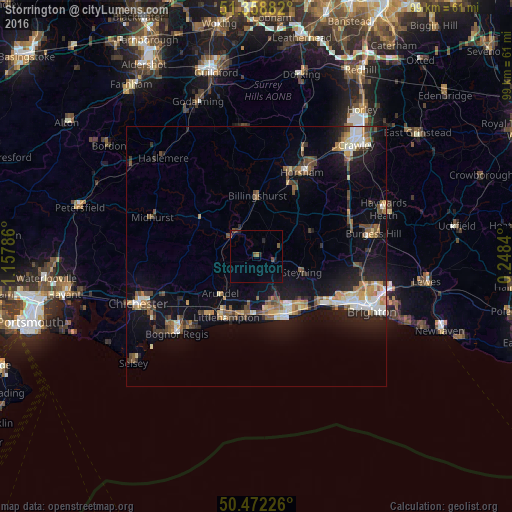
Analysis of Storrington night lights 2016
Square area 10x10 km:
 0%
0%90-99
0%80-89
0%70-79
0%60-69
0.56%50-59
1.12%40-49
1.26%30-39
0.14%20-29
1.4%10-19
0.56%0-9
94.96%Square area 50x50 km:
0.94%90-99
1.35%80-89
0.9%70-79
1.12%60-69
1.34%50-59
1.45%40-49
1.57%30-39
1.16%20-29
2.02%10-19
7.69%0-9
80.46%Clear (daylight) street map image can be seen on geolist.org.
Map coordinates:
51° 21' 31.8" North, 1° 9' 28.3" West
50° 55' 3.5" North, 0° 27' 17" West
50° 28' 20.1" North, 0° 14' 54.2" East
Some cities around Storrington sort by population:
• Worthing
12.4 km =7.7 mi,  153°
153°
• Littlehampton
13.3 km =8.3 mi,  207°
207°
• Lancing
13.6 km =8.5 mi,  136°
136°
• Rustington
12.5 km =7.8 mi,  196°
196°
• Steyning
9.5 km =5.9 mi,  110°
110°
• Southwater
13.8 km =8.6 mi,  31°
31°
• Broadwater
11.3 km =7 mi, 150°
• Billingshurst
11.7 km =7.3 mi,  0°
0°
2636786 (p: 8,618)
Sources (retrieved 2019-11-25):
» Earth at Night: Flat Maps 2012, 2016