Lancing night lights from space
Night Light of Lancing (England) from space (United Kingdom) Src. Average luminocity for 10x10km area is 27.4006% and for 50x50km: 7.3915%.
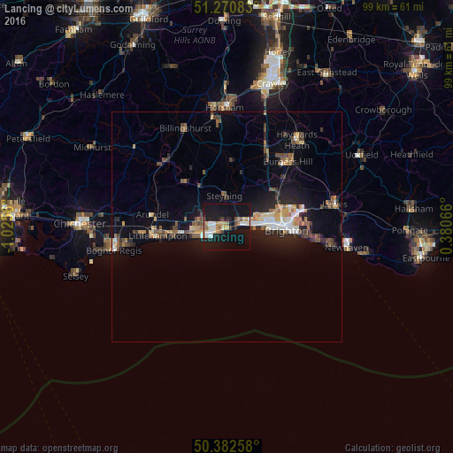
Analysis of Lancing night lights 2016
Square area 10x10 km:
 2.94%
2.94%90-99
5.6%80-89
3.08%70-79
3.78%60-69
4.48%50-59
1.68%40-49
1.54%30-39
1.82%20-29
2.38%10-19
46.5%0-9
26.19%Square area 50x50 km:
0.68%90-99
0.94%80-89
0.71%70-79
0.99%60-69
0.95%50-59
1.13%40-49
1.22%30-39
0.91%20-29
1.78%10-19
6.27%0-9
84.42%Clear (daylight) street map image can be seen on geolist.org.
Map coordinates:
51° 16' 15" North, 1° 1' 32.2" West
50° 49' 43.8" North, 0° 19' 20.9" West
50° 22' 57.3" North, 0° 22' 50.4" East
Some cities around Lancing sort by population:
• Brighton
12.9 km =8 mi,  90°
90°
• Worthing
3.9 km =2.4 mi,  251°
251°
• Hove
10.9 km =6.8 mi, 88°
• Portslade
7.6 km =4.7 mi,  78°
78°
• Shoreham-by-Sea
3.4 km =2.1 mi, 80°
• Rustington
13.1 km =8.1 mi,  260°
260°
• Steyning
6.5 km =4 mi,  356°
356°
• Broadwater
3.8 km =2.4 mi,  270°
270°
2641319 (p: 18,692)
Sources (retrieved 2019-11-25):
» Earth at Night: Flat Maps 2012, 2016