Rustington night lights from space
Night Light of Rustington (England) from space (United Kingdom) Src. Average luminocity for 10x10km area is 17.6653% and for 50x50km: 6.0387%.
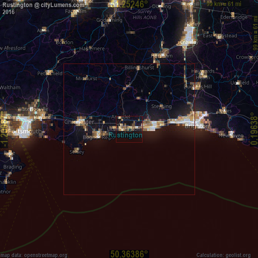
Analysis of Rustington night lights 2016
Square area 10x10 km:
 0%
0%90-99
1.12%80-89
3.36%70-79
1.82%60-69
3.08%50-59
5.18%40-49
2.94%30-39
2.52%20-29
0.98%10-19
10.92%0-9
68.07%Square area 50x50 km:
0.46%90-99
0.76%80-89
0.59%70-79
0.72%60-69
0.87%50-59
1.04%40-49
0.98%30-39
0.77%20-29
1.3%10-19
5.43%0-9
87.08%Clear (daylight) street map image can be seen on geolist.org.
Map coordinates:
51° 15' 8.9" North, 1° 12' 35.5" West
50° 48' 37" North, 0° 30' 24.3" West
50° 21' 49.9" North, 0° 11' 47" East
Some cities around Rustington sort by population:
• Worthing
9.3 km =5.8 mi,  84°
84°
• Bognor Regis
12.6 km =7.8 mi,  255°
255°
• Littlehampton
2.4 km =1.5 mi,  272°
272°
• Barnham
9.5 km =5.9 mi,  284°
284°
• Westergate
12 km =7.5 mi,  285°
285°
• Storrington
12.5 km =7.8 mi,  16°
16°
• Broadwater
9.4 km =5.8 mi, 77°
• Yapton
7.6 km =4.7 mi, 278°
2638930 (p: 13,210)
Sources (retrieved 2019-11-25):
» Earth at Night: Flat Maps 2012, 2016