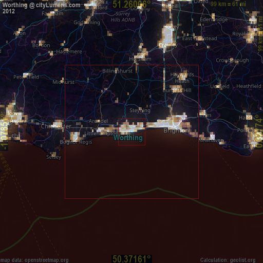
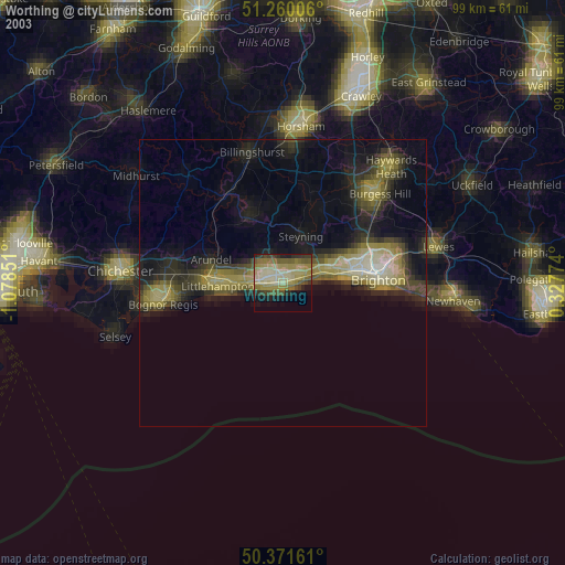
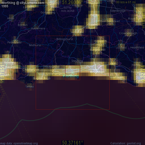
Worthing night lights from space
Night Light of Worthing (England) from space (United Kingdom) Src. Average luminocity for 10x10km area is 30.9664% and for 50x50km: 7.3035%.

Analysis of Worthing night lights 2016
Square area 10x10 km:
 2.94%
2.94%90-99
4.2%80-89
4.2%70-79
5.6%60-69
4.9%50-59
5.04%40-49
3.64%30-39
2.52%20-29
2.8%10-19
42.86%0-9
21.29%Square area 50x50 km:
0.67%90-99
0.93%80-89
0.68%70-79
0.96%60-69
0.99%50-59
1.11%40-49
1.14%30-39
0.95%20-29
1.73%10-19
6.63%0-9
84.21%Clear (daylight) street map image can be seen on geolist.org.
Map coordinates:
51° 15' 36.2" North, 1° 4' 42.6" West
50° 49' 4.6" North, 0° 22' 31.4" West
50° 22' 17.8" North, 0° 19' 39.9" East
Some cities around Worthing sort by population:
• Littlehampton
11.6 km =7.2 mi,  266°
266°
• Portslade
11.5 km =7.1 mi,  76°
76°
• Shoreham-by-Sea
7.3 km =4.5 mi, 75°
• Lancing
3.9 km =2.4 mi,  71°
71°
• Rustington
9.3 km =5.8 mi,  264°
264°
• Steyning
8.4 km =5.2 mi,  23°
23°
• Storrington
12.4 km =7.7 mi,  333°
333°
• Broadwater
1.2 km =0.7 mi,  358°
358°
2633521 (p: 99,110)
Sources (retrieved 2019-11-25):
» NASA, Earths city lights 1995
» NASA city lights 2003
» Earth at Night: Flat Maps 2012, 2016