Billingshurst night lights from space
Night Light of Billingshurst (England) from space (United Kingdom) Src. Average luminocity for 10x10km area is 1.504% and for 50x50km: 11.6325%.
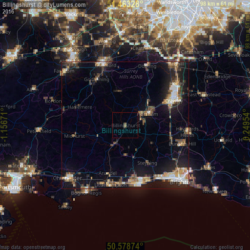
Analysis of Billingshurst night lights 2016
Square area 10x10 km:
 0%
0%90-99
0%80-89
0%70-79
0%60-69
0.67%50-59
0.8%40-49
0.67%30-39
0%20-29
0%10-19
0%0-9
97.86%Square area 50x50 km:
1.22%90-99
1.73%80-89
1.04%70-79
1.34%60-69
1.59%50-59
1.69%40-49
2.22%30-39
1.81%20-29
3%10-19
9.78%0-9
74.57%Clear (daylight) street map image can be seen on geolist.org.
Map coordinates:
51° 27' 47.8" North, 1° 9' 24.2" West
51° 1' 23.2" North, 0° 27' 12.9" West
50° 34' 43.5" North, 0° 14' 58.3" East
Some cities around Billingshurst sort by population:
• Horsham
9.9 km =6.2 mi,  63°
63°
• Broadfield
19.1 km =11.9 mi, 64°
• Cranleigh
13.4 km =8.3 mi,  350°
350°
• Steyning
17.5 km =10.9 mi,  149°
149°
• Bewbush
18.4 km =11.4 mi, 61°
• Southwater
7.1 km =4.4 mi,  89°
89°
• Storrington
11.7 km =7.3 mi,  180°
180°
• Gossops Green
19.2 km =11.9 mi, 59°
2655662 (p: 6,911)
Sources (retrieved 2019-11-25):
» Earth at Night: Flat Maps 2012, 2016