Stocksbridge night lights from space
Night Light of Stocksbridge (England) from space (United Kingdom) Src. Average luminocity for 10x10km area is 7.2262% and for 50x50km: 28.9865%.
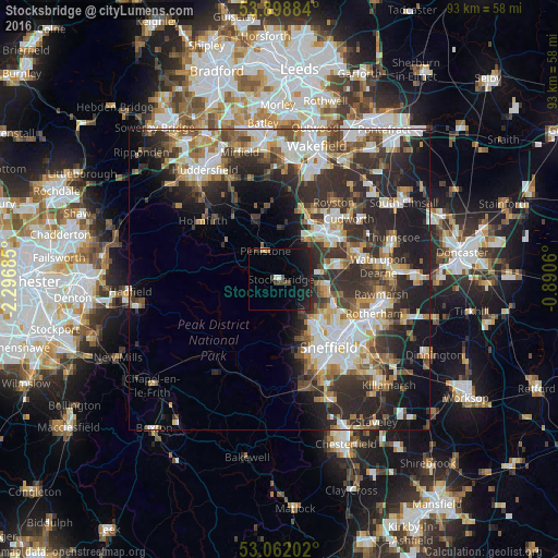
Analysis of Stocksbridge night lights 2016
Square area 10x10 km:
 0.4%
0.4%90-99
0.53%80-89
0.26%70-79
0.4%60-69
0.26%50-59
0%40-49
1.72%30-39
1.98%20-29
1.98%10-19
14.68%0-9
77.78%Square area 50x50 km:
5.35%90-99
5.72%80-89
2.99%70-79
3.31%60-69
3.51%50-59
3.94%40-49
3.97%30-39
6.15%20-29
11.04%10-19
10.67%0-9
43.34%Clear (daylight) street map image can be seen on geolist.org.
Map coordinates:
53° 53' 55.8" North, 2° 17' 48.7" West
53° 28' 57" North, 1° 35' 37.4" West
53° 3' 43.3" North, 0° 53' 26.2" West
Some cities around Stocksbridge sort by population:
• Barnsley
10.5 km =6.5 mi,  44°
44°
• Burngreave
13.4 km =8.3 mi,  137°
137°
• Chapeltown
8.3 km =5.2 mi,  103°
103°
• Hoyland Nether
9.7 km =6 mi,  78°
78°
• Darton
12.4 km =7.7 mi,  20°
20°
• Penistone
5.4 km =3.4 mi,  333°
333°
• Clayton West
12.6 km =7.8 mi,  354°
354°
• Dodworth
8 km =5 mi,  32°
32°
2636881 (p: 13,069)
Sources (retrieved 2019-11-25):
» Earth at Night: Flat Maps 2012, 2016