Barnsley night lights from space
Night Light of Barnsley (England) from space (United Kingdom) Src. Average luminocity for 10x10km area is 54.6481% and for 50x50km: 38.1377%.

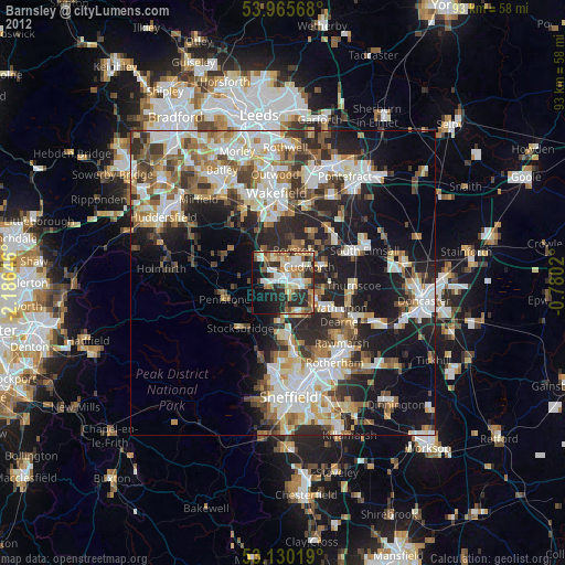
Analysis of Barnsley night lights 2016
Square area 10x10 km:
 9.13%
9.13%90-99
13.36%80-89
4.89%70-79
11.64%60-69
6.61%50-59
5.82%40-49
5.29%30-39
17.46%20-29
8.86%10-19
13.36%0-9
3.57%Square area 50x50 km:
8.35%90-99
8.42%80-89
3.78%70-79
4.43%60-69
4.57%50-59
4.89%40-49
4.93%30-39
6.85%20-29
11%10-19
11.54%0-9
31.22%Clear (daylight) street map image can be seen on geolist.org.
Map coordinates:
53° 57' 56.4" North, 2° 11' 11.3" West
53° 33' 0" North, 1° 28' 60" West
53° 7' 48.7" North, 0° 46' 48.7" West
Some cities around Barnsley sort by population:
• Hoyland Nether
6 km =3.7 mi,  158°
158°
• Wombwell
6.5 km =4 mi,  118°
118°
• Darton
5 km =3.1 mi,  325°
325°
• Cudworth
5 km =3.1 mi,  61°
61°
• Royston
6 km =3.7 mi,  21°
21°
• Darfield
7.3 km =4.5 mi,  104°
104°
• Dodworth
3 km =1.9 mi,  255°
255°
• Ryhill
9.3 km =5.8 mi,  30°
30°
2656284 (p: 71,447)
Sources (retrieved 2019-11-25):
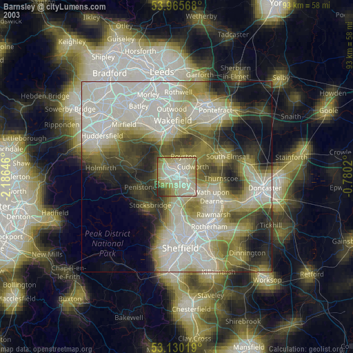
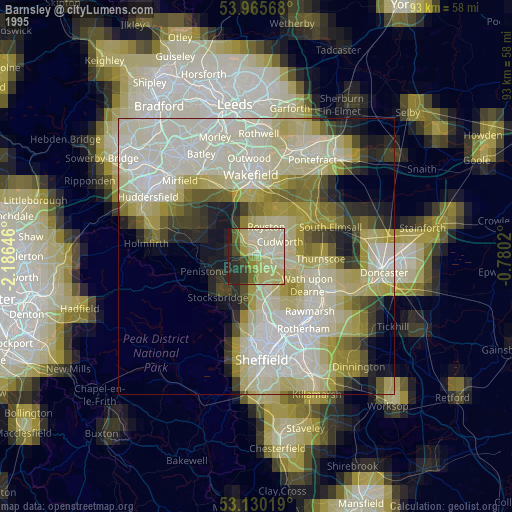
» NASA, Earths city lights 1995
» NASA city lights 2003
» Earth at Night: Flat Maps 2012, 2016