Dodworth night lights from space
Night Light of Dodworth (England) from space (United Kingdom) Src. Average luminocity for 10x10km area is 37.6561% and for 50x50km: 36.9026%.
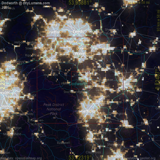
Analysis of Dodworth night lights 2016
Square area 10x10 km:
 6.75%
6.75%90-99
9.66%80-89
3.84%70-79
6.08%60-69
2.25%50-59
3.84%40-49
3.04%30-39
8.99%20-29
9.39%10-19
16.27%0-9
29.89%Square area 50x50 km:
7.66%90-99
8.03%80-89
3.81%70-79
4.54%60-69
4.48%50-59
4.89%40-49
4.9%30-39
6.89%20-29
10.8%10-19
10.95%0-9
33.06%Clear (daylight) street map image can be seen on geolist.org.
Map coordinates:
53° 57' 31.7" North, 2° 13' 51.3" West
53° 32' 35" North, 1° 31' 40" West
53° 7' 23.5" North, 0° 49' 28.8" West
Some cities around Dodworth sort by population:
• Barnsley
3 km =1.9 mi,  75°
75°
• Hoyland Nether
7 km =4.3 mi,  132°
132°
• Darton
4.9 km =3 mi,  0°
0°
• Stocksbridge
8 km =5 mi,  212°
212°
• Cudworth
8 km =5 mi,  66°
66°
• Penistone
7 km =4.3 mi,  254°
254°
• Royston
8.2 km =5.1 mi,  39°
39°
• Clayton West
8 km =5 mi,  316°
316°
2651172 (p: 5,870)
Sources (retrieved 2019-11-25):
» Earth at Night: Flat Maps 2012, 2016