Penistone night lights from space
Night Light of Penistone (England) from space (United Kingdom) Src. Average luminocity for 10x10km area is 5.8399% and for 50x50km: 33.2727%.
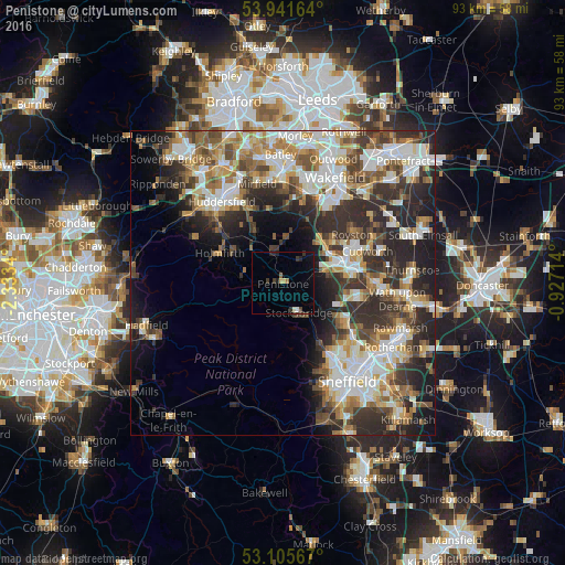
Analysis of Penistone night lights 2016
Square area 10x10 km:
 0.4%
0.4%90-99
0.53%80-89
0.66%70-79
0.53%60-69
0.4%50-59
0.66%40-49
0.53%30-39
1.98%20-29
1.85%10-19
1.32%0-9
91.14%Square area 50x50 km:
6.6%90-99
7.1%80-89
3.49%70-79
4.1%60-69
4.22%50-59
4.6%40-49
4.52%30-39
6.65%20-29
10.53%10-19
8.04%0-9
40.16%Clear (daylight) street map image can be seen on geolist.org.
Map coordinates:
53° 56' 29.9" North, 2° 20' 0.2" West
53° 31' 32.6" North, 1° 37' 49" West
53° 6' 20.4" North, 0° 55' 37.7" West
Some cities around Penistone sort by population:
• Barnsley
10.1 km =6.3 mi,  74°
74°
• Hoyland Nether
12.3 km =7.6 mi,  103°
103°
• Darton
9.7 km =6 mi,  45°
45°
• Stocksbridge
5.4 km =3.4 mi,  153°
153°
• Clayton West
7.8 km =4.8 mi,  9°
9°
• Dodworth
7 km =4.3 mi, 74°
• Shepley
8.6 km =5.3 mi,  318°
318°
• Shelley
9 km =5.6 mi,  337°
337°
2640463 (p: 10,956)
Sources (retrieved 2019-11-25):
» Earth at Night: Flat Maps 2012, 2016