Wisbech night lights from space
Night Light of Wisbech (England) from space (United Kingdom) Src. Average luminocity for 10x10km area is 11.4048% and for 50x50km: 4.0623%.
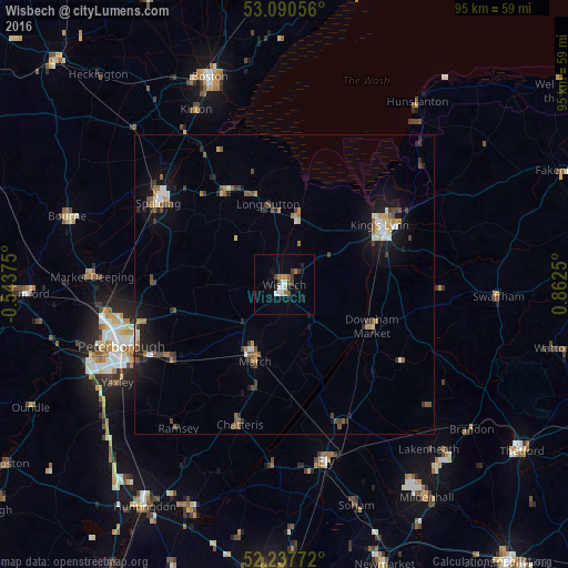
Analysis of Wisbech night lights 2016
Square area 10x10 km:
 1.85%
1.85%90-99
1.85%80-89
0.53%70-79
0.93%60-69
1.72%50-59
1.19%40-49
1.98%30-39
1.59%20-29
0.93%10-19
4.37%0-9
83.07%Square area 50x50 km:
0.39%90-99
0.54%80-89
0.34%70-79
0.38%60-69
0.48%50-59
0.73%40-49
0.7%30-39
0.7%20-29
0.86%10-19
2.63%0-9
92.26%Clear (daylight) street map image can be seen on geolist.org.
Map coordinates:
53° 5' 26" North, 0° 32' 37.5" West
52° 39' 58.4" North, 0° 9' 33.8" East
52° 14' 15.8" North, 0° 51' 45" East
Some cities around Wisbech sort by population:
• King's Lynn
18.5 km =11.5 mi,  59°
59°
• Spalding
24.9 km =15.5 mi,  302°
302°
• March
13.6 km =8.5 mi,  200°
200°
• Whittlesey
23 km =14.3 mi,  238°
238°
• Downham Market
16.5 km =10.3 mi,  113°
113°
• Chatteris
24.4 km =15.2 mi, 197°
• Littleport
25.2 km =15.7 mi,  156°
156°
• Holbeach
18.2 km =11.3 mi,  327°
327°
2633771 (p: 32,489)
Sources (retrieved 2019-11-25):
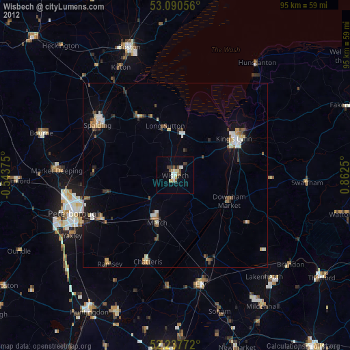
» Earth at Night: Flat Maps 2012, 2016