Slough night lights from space
Night Light of Slough (England) from space (United Kingdom) Src. Average luminocity for 10x10km area is 61.8338% and for 50x50km: 44.4306%.
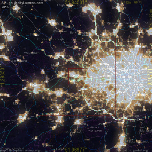
Analysis of Slough night lights 2016
Square area 10x10 km:
 12.08%
90-99
12.34%80-89
8.96%70-79
8.18%60-69
5.32%50-59
10%40-49
13.9%30-39
18.31%20-29
10.52%10-19
0.39%0-9
0%Square area 50x50 km:
9.21%90-99
9.44%80-89
4.16%70-79
4.61%60-69
6.4%50-59
7.08%40-49
7.59%30-39
7.16%20-29
10.66%10-19
14.91%0-9
18.8%Clear (daylight) street map image can be seen on geolist.org.
Map coordinates:
51° 56' 42" North, 1° 17' 54.7" West
51° 30' 34.2" North, 0° 35' 43.5" West
51° 4' 11.2" North, 0° 6' 27.8" East
Some cities around Slough sort by population:
• Maidenhead
8.7 km =5.4 mi,  279°
279°
• Windsor
2.9 km =1.8 mi,  186°
186°
• Gerrards Cross
9 km =5.6 mi,  17°
17°
• Iver Heath
6.1 km =3.8 mi,  60°
60°
• Iver
6.7 km =4.2 mi,  99°
99°
• Old Windsor
5.7 km =3.5 mi,  174°
174°
• Farnham Royal
3.9 km =2.4 mi,  338°
338°
• Colnbrook
5.9 km =3.7 mi,  119°
119°
2637627 (p: 163,777)
Sources (retrieved 2019-11-25):
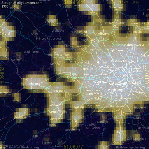
» NASA, Earths city lights 1995
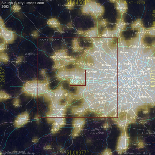
» NASA city lights 2003
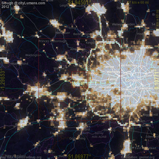
» Earth at Night: Flat Maps 2012, 2016