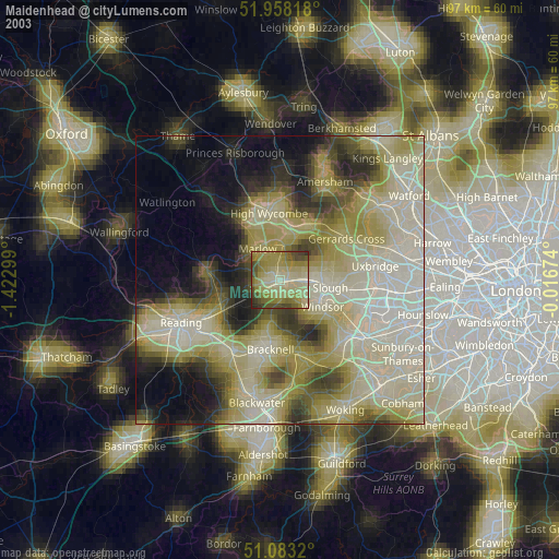
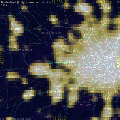
Maidenhead night lights from space
Night Light of Maidenhead (England) from space (United Kingdom) Src. Average luminocity for 10x10km area is 37.5668% and for 50x50km: 33.4948%.

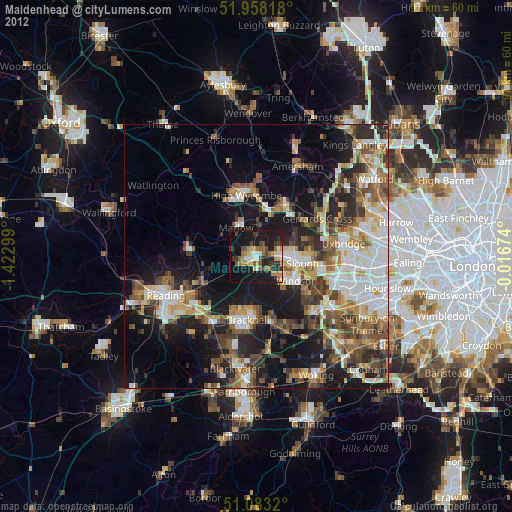
Analysis of Maidenhead night lights 2016
Square area 10x10 km:
 2.41%
2.41%90-99
4.28%80-89
2.94%70-79
4.81%60-69
6.82%50-59
8.69%40-49
6.55%30-39
6.82%20-29
25.8%10-19
28.74%0-9
2.14%Square area 50x50 km:
5.14%90-99
6.11%80-89
3.26%70-79
3.71%60-69
4.61%50-59
6.07%40-49
6.86%30-39
6.07%20-29
10.48%10-19
15.43%0-9
32.27%Clear (daylight) street map image can be seen on geolist.org.
Map coordinates:
51° 57' 29.4" North, 1° 25' 22.8" West
51° 31' 22" North, 0° 43' 11.5" West
51° 4' 59.5" North, 0° 1' 0.3" West
Some cities around Maidenhead sort by population:
• Slough
8.7 km =5.4 mi,  99°
99°
• Windsor
9.4 km =5.8 mi,  117°
117°
• Marlow
6.4 km =4 mi,  324°
324°
• Beaconsfield
11.1 km =6.9 mi,  26°
26°
• Twyford
11.1 km =6.9 mi,  241°
241°
• Farnham Royal
7.5 km =4.7 mi,  73°
73°
• Cookham
4.1 km =2.5 mi,  11°
11°
• Bourne End
6 km =3.7 mi,  4°
4°
2643186 (p: 64,831)
Sources (retrieved 2019-11-25):
» NASA, Earths city lights 1995
» NASA city lights 2003
» Earth at Night: Flat Maps 2012, 2016