Sittingbourne night lights from space
Night Light of Sittingbourne (England) from space (United Kingdom) Src. Average luminocity for 10x10km area is 26.3866% and for 50x50km: 17.5637%.
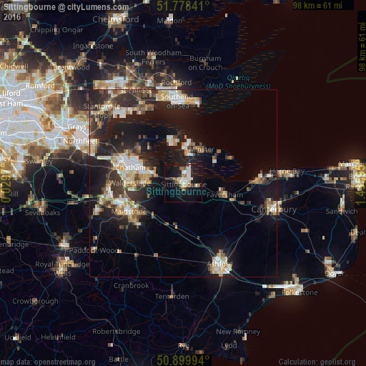
Analysis of Sittingbourne night lights 2016
Square area 10x10 km:
 4.48%
4.48%90-99
5.18%80-89
3.08%70-79
0.98%60-69
4.2%50-59
2.38%40-49
1.82%30-39
3.22%20-29
5.74%10-19
30.67%0-9
38.24%Square area 50x50 km:
2.14%90-99
3.05%80-89
1.98%70-79
2.4%60-69
2.22%50-59
1.65%40-49
2.38%30-39
3.14%20-29
6.36%10-19
14.29%0-9
60.39%Clear (daylight) street map image can be seen on geolist.org.
Map coordinates:
51° 46' 42.3" North, 0° 1' 46.9" East
51° 20' 28.6" North, 0° 43' 58.2" East
50° 53' 59.8" North, 1° 26' 9.4" East
Some cities around Sittingbourne sort by population:
• Maidstone
17.2 km =10.7 mi,  241°
241°
• Gillingham
13.8 km =8.6 mi,  292°
292°
• Chatham
14.8 km =9.2 mi, 286°
• Rochester
16.6 km =10.3 mi, 288°
• Faversham
11.2 km =7 mi,  105°
105°
• Sheerness
11.2 km =7 mi,  10°
10°
• Rainham
8.9 km =5.5 mi, 285°
• Hoo
14.7 km =9.1 mi,  306°
306°
2637802 (p: 48,948)
Sources (retrieved 2019-11-25):
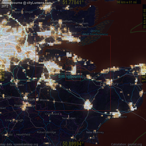
» Earth at Night: Flat Maps 2012, 2016