Hoo night lights from space
Night Light of Hoo (England) from space (United Kingdom) Src. Average luminocity for 10x10km area is 36.6725% and for 50x50km: 27.2488%.
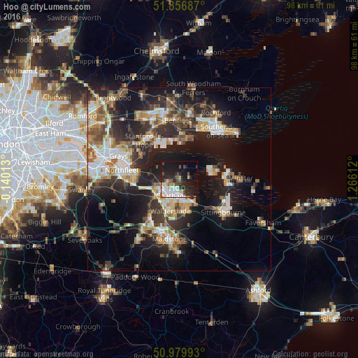
Analysis of Hoo night lights 2016
Square area 10x10 km:
 7.49%
7.49%90-99
8.69%80-89
3.48%70-79
3.07%60-69
2.01%50-59
2.41%40-49
6.15%30-39
4.28%20-29
15.11%10-19
28.88%0-9
18.45%Square area 50x50 km:
3.86%90-99
5.05%80-89
2.95%70-79
3.38%60-69
3.71%50-59
3.3%40-49
3.94%30-39
5.27%20-29
9.43%10-19
16.93%0-9
42.17%Clear (daylight) street map image can be seen on geolist.org.
Map coordinates:
51° 51' 24.7" North, 0° 8' 24.5" West
51° 25' 13.8" North, 0° 33' 46.8" East
50° 58' 47.7" North, 1° 15' 58" East
Some cities around Hoo sort by population:
• Gillingham
3.6 km =2.2 mi,  195°
195°
• Chatham
5.2 km =3.2 mi,  207°
207°
• Canvey Island
11.4 km =7.1 mi,  6°
6°
• Strood
6.7 km =4.2 mi,  243°
243°
• Rochester
5.4 km =3.4 mi,  227°
227°
• Snodland
13.1 km =8.1 mi,  219°
219°
• Rainham
7.1 km =4.4 mi,  153°
153°
• East Tilbury
12.1 km =7.5 mi,  303°
303°
2646656 (p: 5,377)
Sources (retrieved 2019-11-25):
» Earth at Night: Flat Maps 2012, 2016