Sinfin night lights from space
Night Light of Sinfin (England) from space (United Kingdom) Src. Average luminocity for 10x10km area is 59.5038% and for 50x50km: 26.7664%.
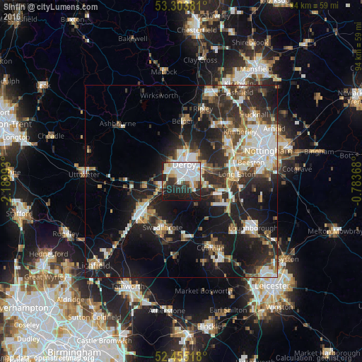
Analysis of Sinfin night lights 2016
Square area 10x10 km:
 23.61%
90-99
15.15%80-89
4.67%70-79
4.42%60-69
3.41%50-59
2.27%40-49
2.27%30-39
5.68%20-29
18.69%10-19
19.82%0-9
0%Square area 50x50 km:
4.95%90-99
5.33%80-89
2.58%70-79
2.48%60-69
3.03%50-59
2.98%40-49
3.28%30-39
4.39%20-29
9.76%10-19
19.56%0-9
41.64%Clear (daylight) street map image can be seen on geolist.org.
Map coordinates:
53° 18' 13.7" North, 2° 11' 23.7" West
52° 52' 53.7" North, 1° 29' 12.5" West
52° 27' 18.6" North, 0° 47' 1.2" West
Some cities around Sinfin sort by population:
• Derby
4.6 km =2.9 mi,  8°
8°
• Burton upon Trent
13.3 km =8.3 mi,  231°
231°
• Long Eaton
14.6 km =9.1 mi,  82°
82°
• Swadlincote
12.9 km =8 mi,  201°
201°
• Castle Donington
10.6 km =6.6 mi,  113°
113°
• West Hallam
13.1 km =8.1 mi,  40°
40°
• Borrowash
7.4 km =4.6 mi,  67°
67°
• Kilburn
14.2 km =8.8 mi, 13°
11863036 (p: 15,128)
Sources (retrieved 2019-11-25):
» Earth at Night: Flat Maps 2012, 2016