Scunthorpe night lights from space
Night Light of Scunthorpe (England) from space (United Kingdom) Src. Average luminocity for 10x10km area is 43.3346% and for 50x50km: 10.8104%.
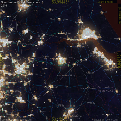
Analysis of Scunthorpe night lights 2016
Square area 10x10 km:
 6.06%
6.06%90-99
9.6%80-89
7.83%70-79
8.59%60-69
2.78%50-59
4.17%40-49
2.65%30-39
5.05%20-29
12.88%10-19
29.55%0-9
10.86%Square area 50x50 km:
1.82%90-99
2.08%80-89
1.11%70-79
0.96%60-69
0.88%50-59
1.5%40-49
1.09%30-39
1.84%20-29
2.59%10-19
7.08%0-9
79.05%Clear (daylight) street map image can be seen on geolist.org.
Map coordinates:
53° 59' 40" North, 1° 21' 27" West
53° 34' 44.6" North, 0° 39' 15.7" West
53° 9' 34.3" North, 0° 2' 55.5" East
Some cities around Scunthorpe sort by population:
• Goole
20.2 km =12.6 mi,  313°
313°
• Brough
17.5 km =10.9 mi,  18°
18°
• Thorne
20.7 km =12.9 mi,  279°
279°
• Barton upon Humber
18.5 km =11.5 mi,  48°
48°
• Scalby
21.3 km =13.2 mi,  348°
348°
• North Ferriby
18.6 km =11.6 mi,  31°
31°
• Brigg
11.1 km =6.9 mi,  105°
105°
• Skelton
20.4 km =12.7 mi,  322°
322°
2638324 (p: 79,977)
Sources (retrieved 2019-11-25):
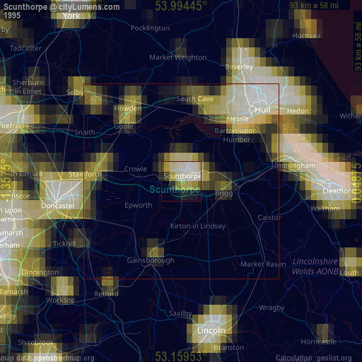
» NASA, Earths city lights 1995
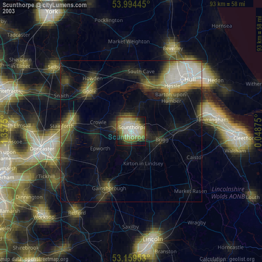
» NASA city lights 2003
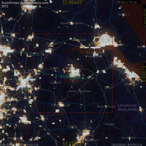
» Earth at Night: Flat Maps 2012, 2016