Brigg night lights from space
Night Light of Brigg (England) from space (United Kingdom) Src. Average luminocity for 10x10km area is 5.5344% and for 50x50km: 10.8592%.
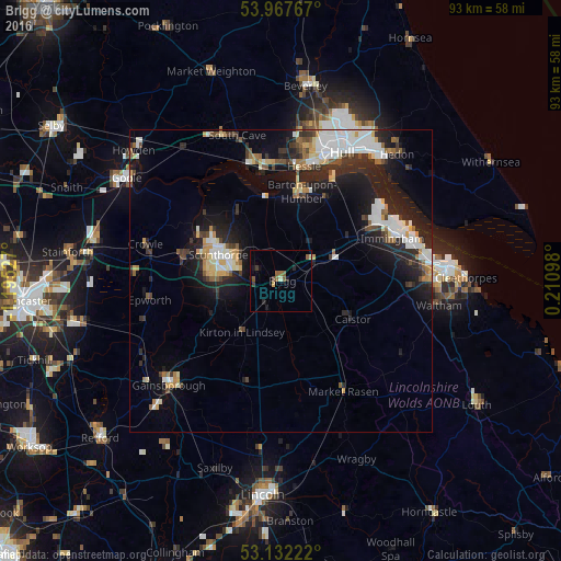
Analysis of Brigg night lights 2016
Square area 10x10 km:
 0%
0%90-99
0.66%80-89
0.13%70-79
0.53%60-69
0.4%50-59
3.31%40-49
0.53%30-39
1.06%20-29
1.46%10-19
1.59%0-9
90.34%Square area 50x50 km:
2%90-99
2.28%80-89
0.94%70-79
1%60-69
0.86%50-59
1.22%40-49
1.02%30-39
1.57%20-29
3.67%10-19
7.67%0-9
77.74%Clear (daylight) street map image can be seen on geolist.org.
Map coordinates:
53° 58' 3.6" North, 1° 11' 43" West
53° 33' 7.2" North, 0° 29' 31.7" West
53° 7' 56" North, 0° 12' 39.5" East
Some cities around Brigg sort by population:
• Kingston upon Hull
23.8 km =14.8 mi,  25°
25°
• Scunthorpe
11.1 km =6.9 mi,  285°
285°
• Gainsborough
26.1 km =16.2 mi,  224°
224°
• Brough
20.3 km =12.6 mi,  344°
344°
• Barton upon Humber
15.6 km =9.7 mi,  11°
11°
• Immingham
19.5 km =12.1 mi,  69°
69°
• North Ferriby
18.8 km =11.7 mi,  357°
357°
• Waltham
26.2 km =16.3 mi,  98°
98°
2654721 (p: 6,787)
Sources (retrieved 2019-11-25):
» Earth at Night: Flat Maps 2012, 2016