Scalby night lights from space
Night Light of Scalby (England) from space (United Kingdom) Src. Average luminocity for 10x10km area is 2.8386% and for 50x50km: 11.0764%.
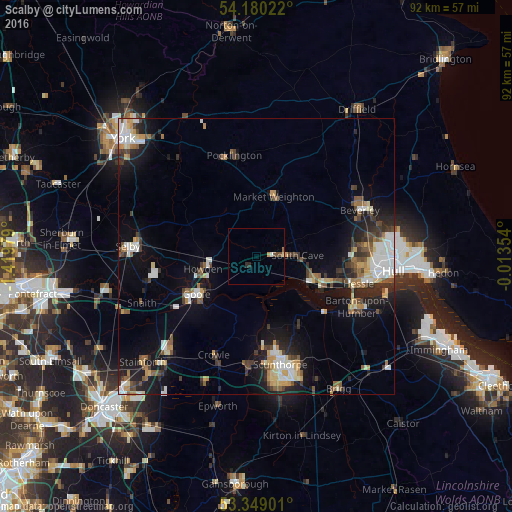
Analysis of Scalby night lights 2016
Square area 10x10 km:
 0.26%
0.26%90-99
0.26%80-89
0.26%70-79
0.53%60-69
0.13%50-59
0.66%40-49
1.06%30-39
0%20-29
1.06%10-19
0%0-9
95.77%Square area 50x50 km:
1.69%90-99
2%80-89
1.16%70-79
1.08%60-69
1.1%50-59
1.67%40-49
1.31%30-39
1.77%20-29
2.7%10-19
7.3%0-9
78.21%Clear (daylight) street map image can be seen on geolist.org.
Map coordinates:
54° 10' 48.8" North, 1° 25' 11.2" West
53° 46' 0" North, 0° 43' 0" West
53° 20' 56.4" North, 0° 0' 48.7" West
Some cities around Scalby sort by population:
• Beverley
21.2 km =13.2 mi,  65°
65°
• Goole
12.7 km =7.9 mi,  236°
236°
• Brough
10.4 km =6.5 mi,  114°
114°
• Barton upon Humber
19.9 km =12.4 mi,  115°
115°
• Pocklington
19 km =11.8 mi,  347°
347°
• North Ferriby
14.8 km =9.2 mi, 109°
• Skelton
9.4 km =5.8 mi, 240°
• Market Weighton
11.2 km =7 mi,  17°
17°
2638448 (p: 9,462)
Sources (retrieved 2019-11-25):
» Earth at Night: Flat Maps 2012, 2016