Thorne night lights from space
Night Light of Thorne (England) from space (United Kingdom) Src. Average luminocity for 10x10km area is 17.2702% and for 50x50km: 17.0447%.
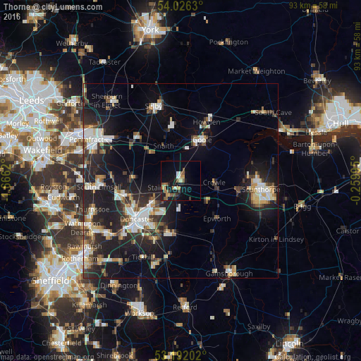
Analysis of Thorne night lights 2016
Square area 10x10 km:
 1.77%
1.77%90-99
0.76%80-89
2.27%70-79
1.77%60-69
2.78%50-59
5.81%40-49
1.01%30-39
1.52%20-29
2.53%10-19
16.92%0-9
62.88%Square area 50x50 km:
2.72%90-99
2.88%80-89
1.77%70-79
1.73%60-69
1.58%50-59
2.01%40-49
1.92%30-39
2.94%20-29
6.47%10-19
13.03%0-9
62.95%Clear (daylight) street map image can be seen on geolist.org.
Map coordinates:
54° 1' 34.7" North, 1° 39' 58.3" West
53° 36' 40.4" North, 0° 57' 47.1" West
53° 11' 31.3" North, 0° 15' 35.8" West
Some cities around Thorne sort by population:
• Doncaster
14.8 km =9.2 mi,  228°
228°
• Goole
11.7 km =7.3 mi,  28°
28°
• Kirk Sandall
8.9 km =5.5 mi, 231°
• Armthorpe
10.3 km =6.4 mi,  215°
215°
• Carcroft
14.4 km =8.9 mi,  257°
257°
• Skelton
15 km =9.3 mi, 32°
• Stainforth
4.8 km =3 mi,  254°
254°
• Askern
12.5 km =7.8 mi,  272°
272°
2635997 (p: 17,295)
Sources (retrieved 2019-11-25):
» Earth at Night: Flat Maps 2012, 2016