Barnham night lights from space
Night Light of Barnham (England) from space (United Kingdom) Src. Average luminocity for 10x10km area is 14.2017% and for 50x50km: 4.9903%.
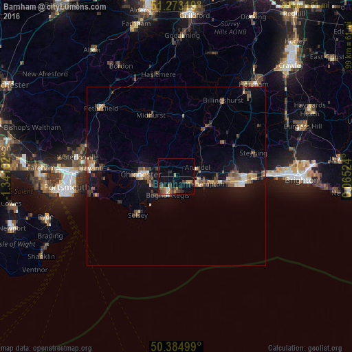
Analysis of Barnham night lights 2016
Square area 10x10 km:
 0.7%
0.7%90-99
0.42%80-89
0.98%70-79
2.66%60-69
2.8%50-59
1.96%40-49
3.64%30-39
3.08%20-29
4.2%10-19
6.16%0-9
73.39%Square area 50x50 km:
0.28%90-99
0.43%80-89
0.42%70-79
0.64%60-69
0.84%50-59
0.98%40-49
0.95%30-39
0.93%20-29
0.75%10-19
4.3%0-9
89.48%Clear (daylight) street map image can be seen on geolist.org.
Map coordinates:
51° 16' 23.5" North, 1° 20' 27.7" West
50° 49' 52.3" North, 0° 38' 16.4" West
50° 23' 6" North, 0° 3' 54.9" East
Some cities around Barnham sort by population:
• Bognor Regis
6.2 km =3.9 mi,  208°
208°
• Littlehampton
7.2 km =4.5 mi,  107°
107°
• Chichester
10 km =6.2 mi,  273°
273°
• Rustington
9.5 km =5.9 mi,  104°
104°
• Selsey
15.1 km =9.4 mi,  224°
224°
• Westergate
2.5 km =1.6 mi,  292°
292°
• Storrington
16 km =9.9 mi,  53°
53°
• Yapton
2.1 km =1.3 mi,  123°
123°
2656293 (p: 11,881)
Sources (retrieved 2019-11-25):
» Earth at Night: Flat Maps 2012, 2016