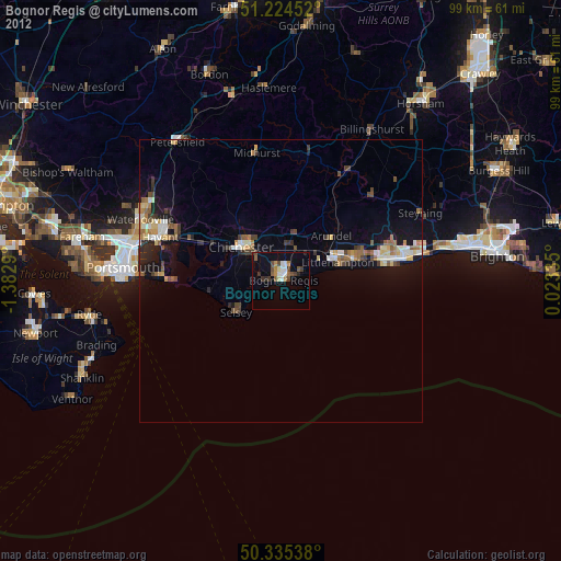
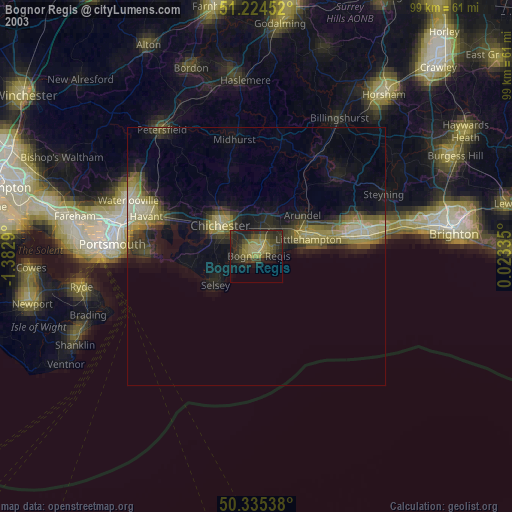
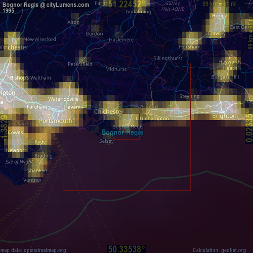
Bognor Regis night lights from space
Night Light of Bognor Regis (England) from space (United Kingdom) Src. Average luminocity for 10x10km area is 17.895% and for 50x50km: 5.1264%.

Analysis of Bognor Regis night lights 2016
Square area 10x10 km:
 1.26%
1.26%90-99
2.1%80-89
0.98%70-79
1.26%60-69
3.22%50-59
2.66%40-49
4.76%30-39
5.74%20-29
3.08%10-19
13.73%0-9
61.2%Square area 50x50 km:
0.29%90-99
0.49%80-89
0.41%70-79
0.65%60-69
0.77%50-59
1.03%40-49
1.09%30-39
0.97%20-29
1.12%10-19
4.32%0-9
88.86%Clear (daylight) street map image can be seen on geolist.org.
Map coordinates:
51° 13' 28.3" North, 1° 22' 58.4" West
50° 46' 55.4" North, 0° 40' 47.2" West
50° 20' 7.4" North, 0° 1' 24.1" East
Some cities around Bognor Regis sort by population:
• Littlehampton
10.3 km =6.4 mi,  71°
71°
• Chichester
9.3 km =5.8 mi,  310°
310°
• Rustington
12.6 km =7.8 mi,  75°
75°
• Barnham
6.2 km =3.9 mi,  28°
28°
• Selsey
9.3 km =5.8 mi,  235°
235°
• Westergate
6.5 km =4 mi,  5°
5°
• East Wittering
13.8 km =8.6 mi,  264°
264°
• Yapton
6.4 km =4 mi,  47°
47°
2655262 (p: 63,885)
Sources (retrieved 2019-11-25):
» NASA, Earths city lights 1995
» NASA city lights 2003
» Earth at Night: Flat Maps 2012, 2016