Rugeley night lights from space
Night Light of Rugeley (England) from space (United Kingdom) Src. Average luminocity for 10x10km area is 15.1604% and for 50x50km: 25.1368%.
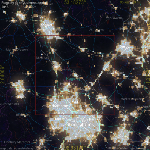
Analysis of Rugeley night lights 2016
Square area 10x10 km:
 1.26%
1.26%90-99
1.77%80-89
0.51%70-79
1.01%60-69
1.01%50-59
2.9%40-49
4.04%30-39
0.88%20-29
4.04%10-19
24.37%0-9
58.21%Square area 50x50 km:
5.69%90-99
5.27%80-89
2.2%70-79
2.81%60-69
2.98%50-59
2.65%40-49
2.94%30-39
2.54%20-29
6.16%10-19
16.05%0-9
50.71%Clear (daylight) street map image can be seen on geolist.org.
Map coordinates:
53° 10' 57.8" North, 2° 38' 24.2" West
52° 45' 33.5" North, 1° 56' 13" West
52° 19' 54.2" North, 1° 14' 1.7" West
Some cities around Rugeley sort by population:
• Cannock
9.9 km =6.2 mi,  219°
219°
• Stafford
13.1 km =8.1 mi,  292°
292°
• Lichfield
11.4 km =7.1 mi,  139°
139°
• Burntwood
8.8 km =5.5 mi,  175°
175°
• Great Wyrley
11.8 km =7.3 mi,  204°
204°
• Chasetown
9.7 km =6 mi, 175°
• Penkridge
12.6 km =7.8 mi,  252°
252°
• Norton Canes
9.9 km =6.2 mi,  190°
190°
2638977 (p: 24,033)
Sources (retrieved 2019-11-25):
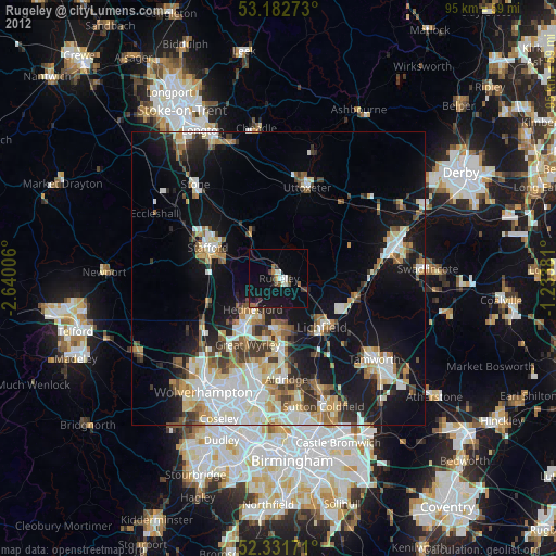
» Earth at Night: Flat Maps 2012, 2016