Stafford night lights from space
Night Light of Stafford (England) from space (United Kingdom) Src. Average luminocity for 10x10km area is 29.7146% and for 50x50km: 19.9371%.
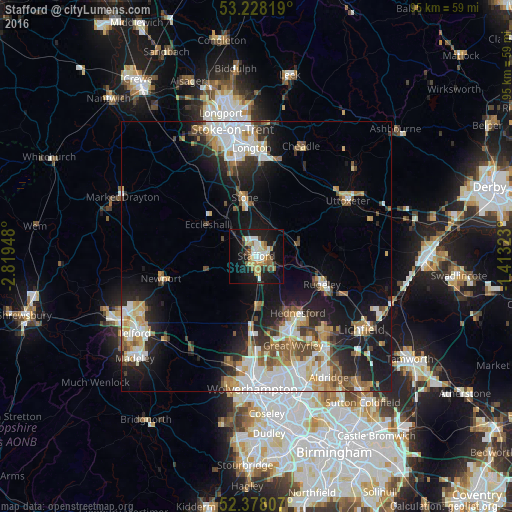
Analysis of Stafford night lights 2016
Square area 10x10 km:
 4.55%
4.55%90-99
5.05%80-89
3.28%70-79
4.42%60-69
4.92%50-59
3.16%40-49
2.53%30-39
2.4%20-29
4.67%10-19
32.95%0-9
32.07%Square area 50x50 km:
4.31%90-99
4.02%80-89
1.82%70-79
2.38%60-69
2.45%50-59
2.39%40-49
2.28%30-39
2.1%20-29
4.48%10-19
12.48%0-9
61.28%Clear (daylight) street map image can be seen on geolist.org.
Map coordinates:
53° 13' 41.5" North, 2° 49' 10.1" West
52° 48' 18.8" North, 2° 6' 58.9" West
52° 22' 41.1" North, 1° 24' 47.6" West
Some cities around Stafford sort by population:
• Cannock
14 km =8.7 mi,  155°
155°
• Rugeley
13.1 km =8.1 mi,  112°
112°
• Great Wyrley
17.4 km =10.8 mi, 155°
• Stone
11.5 km =7.1 mi,  347°
347°
• Featherstone
17.9 km =11.1 mi,  174°
174°
• Newport
18.1 km =11.2 mi,  256°
256°
• Penkridge
8.9 km =5.5 mi,  179°
179°
• Norton Canes
18.1 km =11.2 mi,  145°
145°
2637142 (p: 69,217)
Sources (retrieved 2019-11-25):
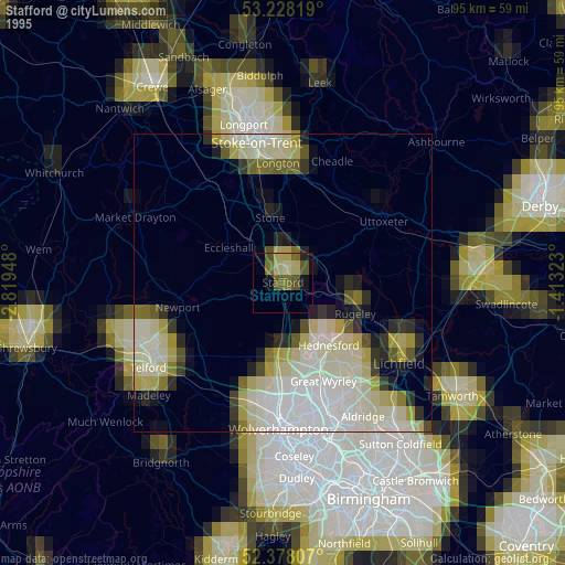
» NASA, Earths city lights 1995
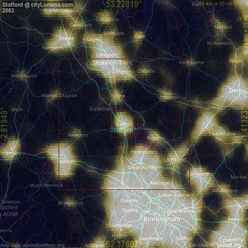
» NASA city lights 2003
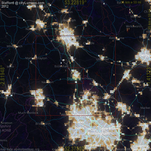
» Earth at Night: Flat Maps 2012, 2016