Cannock night lights from space
Night Light of Cannock (England) from space (United Kingdom) Src. Average luminocity for 10x10km area is 50.5741% and for 50x50km: 31.5972%.
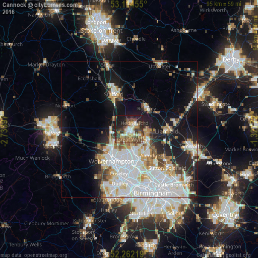
Analysis of Cannock night lights 2016
Square area 10x10 km:
 5.95%
5.95%90-99
8.6%80-89
4.23%70-79
5.95%60-69
9.39%50-59
12.83%40-49
13.49%30-39
10.45%20-29
13.89%10-19
14.81%0-9
0.4%Square area 50x50 km:
10.44%90-99
7.93%80-89
2.72%70-79
2.87%60-69
2.93%50-59
2.4%40-49
2.8%30-39
2.19%20-29
4.91%10-19
12.6%0-9
48.23%Clear (daylight) street map image can be seen on geolist.org.
Map coordinates:
53° 6' 52.4" North, 2° 44' 2.3" West
52° 41' 25.6" North, 2° 1' 51.1" West
52° 15' 43.9" North, 1° 19' 39.8" West
Some cities around Cannock sort by population:
• Bloxwich
8.2 km =5.1 mi,  167°
167°
• Burntwood
7 km =4.3 mi,  98°
98°
• Great Wyrley
3.4 km =2.1 mi,  156°
156°
• Featherstone
6.6 km =4.1 mi,  219°
219°
• Pelsall
8.1 km =5 mi,  147°
147°
• Chasetown
7.4 km =4.6 mi,  105°
105°
• Penkridge
6.9 km =4.3 mi,  304°
304°
• Norton Canes
5.1 km =3.2 mi, 114°
2653883 (p: 86,121)
Sources (retrieved 2019-11-25):
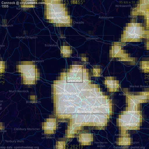
» NASA, Earths city lights 1995
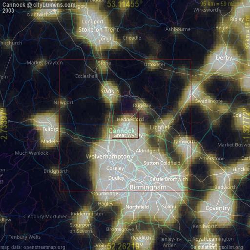
» NASA city lights 2003
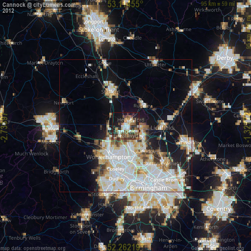
» Earth at Night: Flat Maps 2012, 2016