Keyworth night lights from space
Night Light of Keyworth (England) from space (United Kingdom) Src. Average luminocity for 10x10km area is 14.2247% and for 50x50km: 23.8114%.
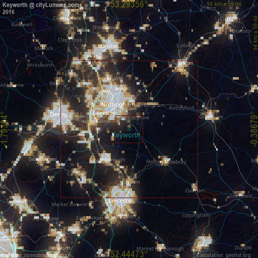
Analysis of Keyworth night lights 2016
Square area 10x10 km:
 0.25%
0.25%90-99
1.26%80-89
1.52%70-79
0%60-69
1.26%50-59
4.55%40-49
4.17%30-39
1.89%20-29
7.95%10-19
15.91%0-9
61.24%Square area 50x50 km:
4.18%90-99
4.67%80-89
2.4%70-79
2.27%60-69
2.98%50-59
3.18%40-49
3.09%30-39
4.02%20-29
8.59%10-19
14.48%0-9
50.15%Clear (daylight) street map image can be seen on geolist.org.
Map coordinates:
53° 17' 36.8" North, 1° 47' 34.9" West
52° 52' 16.4" North, 1° 5' 23.7" West
52° 26' 41" North, 0° 23' 12.4" West
Some cities around Keyworth sort by population:
• Nottingham
10 km =6.2 mi,  336°
336°
• West Bridgford
6.9 km =4.3 mi, 339°
• Basford
12.3 km =7.6 mi,  329°
329°
• Bingham
12.4 km =7.7 mi,  45°
45°
• Radcliffe on Trent
9.2 km =5.7 mi,  21°
21°
• Cotgrave
5.4 km =3.4 mi,  40°
40°
• Ruddington
4.7 km =2.9 mi,  300°
300°
• East Leake
7.6 km =4.7 mi,  233°
233°
11238357 (p: 6,733)
Sources (retrieved 2019-11-25):
» Earth at Night: Flat Maps 2012, 2016