Ripon night lights from space
Night Light of Ripon (England) from space (United Kingdom) Src. Average luminocity for 10x10km area is 3.5177% and for 50x50km: 2.9993%.
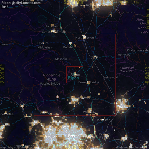
Analysis of Ripon night lights 2016
Square area 10x10 km:
 0%
0%90-99
0%80-89
1.01%70-79
0.51%60-69
0.88%50-59
1.14%40-49
0%30-39
1.52%20-29
0%10-19
0%0-9
94.95%Square area 50x50 km:
0.2%90-99
0.35%80-89
0.34%70-79
0.41%60-69
0.51%50-59
0.36%40-49
0.42%30-39
0.36%20-29
0.34%10-19
2.06%0-9
94.64%Clear (daylight) street map image can be seen on geolist.org.
Map coordinates:
54° 32' 44.4" North, 2° 13' 53" West
54° 8' 8.8" North, 1° 31' 41.7" West
53° 43' 18.5" North, 0° 49' 30.5" West
Some cities around Ripon sort by population:
• Harrogate
16.1 km =10 mi,  182°
182°
• Northallerton
23.4 km =14.5 mi,  15°
15°
• Knaresborough
14.6 km =9.1 mi,  164°
164°
• Otley
27.8 km =17.3 mi,  202°
202°
• Wetherby
24.8 km =15.4 mi, 158°
• Thirsk
16.1 km =10 mi,  47°
47°
• Boston Spa
28.4 km =17.6 mi, 155°
• Burley in Wharfedale
29.2 km =18.1 mi,  210°
210°
2639323 (p: 16,363)
Sources (retrieved 2019-11-25):
» Earth at Night: Flat Maps 2012, 2016