Reigate night lights from space
Night Light of Reigate (England) from space (United Kingdom) Src. Average luminocity for 10x10km area is 34.0294% and for 50x50km: 31.6987%.
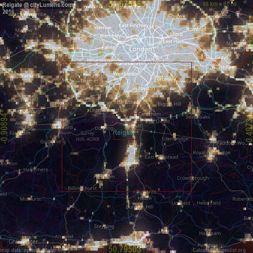
Analysis of Reigate night lights 2016
Square area 10x10 km:
 2.24%
2.24%90-99
6.3%80-89
3.08%70-79
3.22%60-69
5.18%50-59
6.3%40-49
7%30-39
5.74%20-29
18.07%10-19
26.05%0-9
16.81%Square area 50x50 km:
7.91%90-99
6.46%80-89
3.2%70-79
3.69%60-69
4.47%50-59
4.32%40-49
4.72%30-39
4.23%20-29
5.29%10-19
8.48%0-9
47.23%Clear (daylight) street map image can be seen on geolist.org.
Map coordinates:
51° 40' 31.7" North, 0° 54' 32.2" West
51° 14' 14.5" North, 0° 12' 21" West
50° 47' 42.1" North, 0° 29' 50.3" East
Some cities around Reigate sort by population:
• Redhill
2.5 km =1.6 mi,  81°
81°
• Banstead
9.4 km =5.8 mi,  359°
359°
• Coulsdon
10.2 km =6.3 mi,  26°
26°
• Horley
7.7 km =4.8 mi,  155°
155°
• Caterham
10.1 km =6.3 mi,  60°
60°
• Dorking
8.9 km =5.5 mi,  266°
266°
• Ashtead
10.3 km =6.4 mi,  320°
320°
• Tadworth
6.4 km =4 mi,  340°
340°
2639506 (p: 52,123)
Sources (retrieved 2019-11-25):
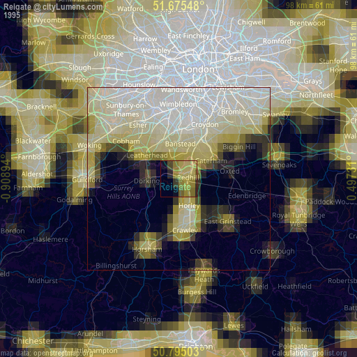
» NASA, Earths city lights 1995
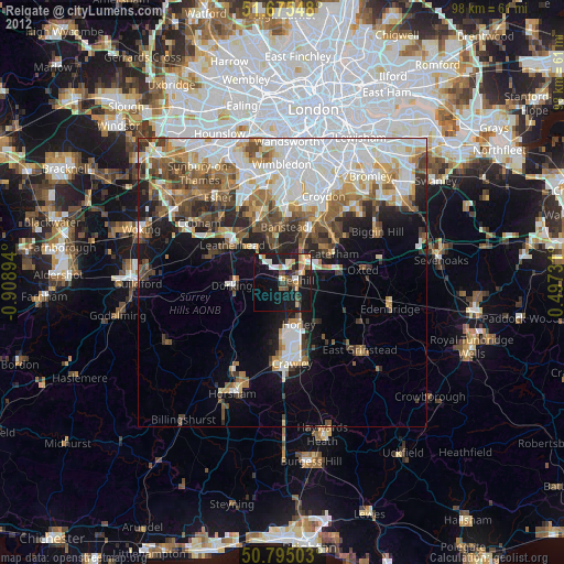
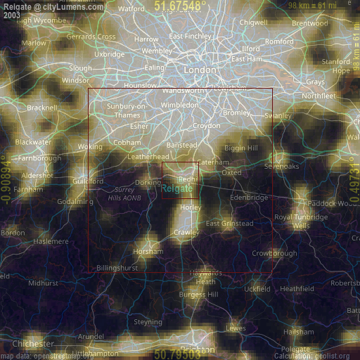
» NASA city lights 2003
» Earth at Night: Flat Maps 2012, 2016