Redhill night lights from space
Night Light of Redhill (England) from space (United Kingdom) Src. Average luminocity for 10x10km area is 36.4034% and for 50x50km: 32.2736%.
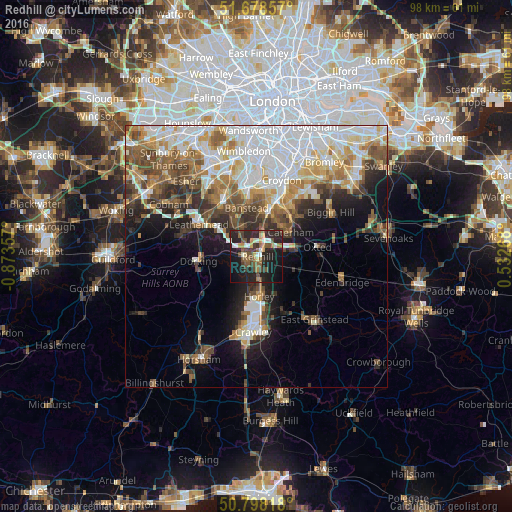
Analysis of Redhill night lights 2016
Square area 10x10 km:
 2.52%
2.52%90-99
5.46%80-89
3.08%70-79
3.22%60-69
6.16%50-59
6.86%40-49
8.12%30-39
5.74%20-29
23.95%10-19
28.57%0-9
6.3%Square area 50x50 km:
8.43%90-99
6.69%80-89
3.3%70-79
3.64%60-69
4.44%50-59
4.35%40-49
4.67%30-39
3.86%20-29
5.03%10-19
8.34%0-9
47.26%Clear (daylight) street map image can be seen on geolist.org.
Map coordinates:
51° 40' 42.9" North, 0° 52' 24.9" West
51° 14' 25.7" North, 0° 10' 13.6" West
50° 47' 53.4" North, 0° 31' 57.6" East
Some cities around Redhill sort by population:
• Reigate
2.5 km =1.6 mi,  261°
261°
• Banstead
9.4 km =5.8 mi,  344°
344°
• Coulsdon
9.1 km =5.7 mi,  13°
13°
• Horley
7.4 km =4.6 mi,  173°
173°
• Caterham
7.9 km =4.9 mi,  53°
53°
• Dorking
11.4 km =7.1 mi,  265°
265°
• Warlingham
11 km =6.8 mi, 45°
• Tadworth
7.3 km =4.5 mi,  321°
321°
2639545 (p: 51,559)
Sources (retrieved 2019-11-25):
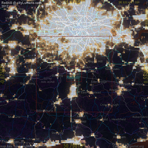
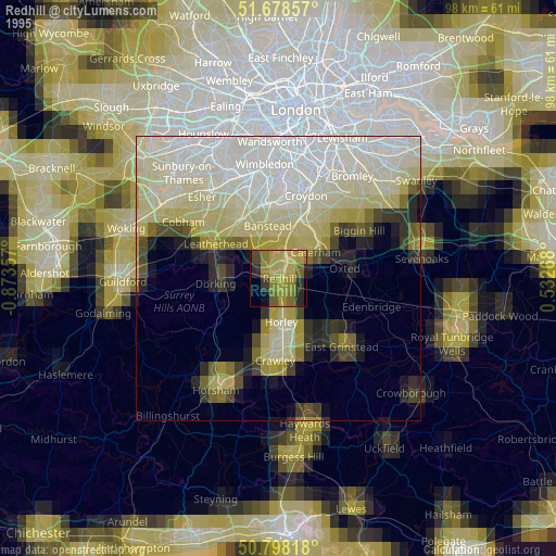
» NASA, Earths city lights 1995
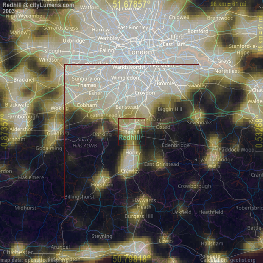
» NASA city lights 2003
» Earth at Night: Flat Maps 2012, 2016