Calverton night lights from space
Night Light of Calverton (England) from space (United Kingdom) Src. Average luminocity for 10x10km area is 23.664% and for 50x50km: 24.7165%.
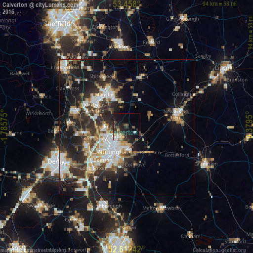
Analysis of Calverton night lights 2016
Square area 10x10 km:
 3.31%
3.31%90-99
2.51%80-89
3.44%70-79
1.59%60-69
0.79%50-59
3.17%40-49
4.37%30-39
6.22%20-29
10.71%10-19
23.68%0-9
40.21%Square area 50x50 km:
4.35%90-99
5.11%80-89
2.38%70-79
2.53%60-69
2.76%50-59
3.08%40-49
3.31%30-39
4.67%20-29
9.19%10-19
13.36%0-9
49.26%Clear (daylight) street map image can be seen on geolist.org.
Map coordinates:
53° 27' 28.8" North, 1° 47' 8.7" West
53° 2' 14.2" North, 1° 4' 57.5" West
52° 36' 44.7" North, 0° 22' 46.2" West
Some cities around Calverton sort by population:
• Arnold
5.4 km =3.4 mi,  219°
219°
• Hucknall
7.9 km =4.9 mi,  266°
266°
• Basford
10.3 km =6.4 mi, 220°
• New Basford
9 km =5.6 mi, 218°
• Rainworth
9.4 km =5.8 mi,  345°
345°
• Radcliffe on Trent
10.4 km =6.5 mi,  163°
163°
• Southwell
9.6 km =6 mi,  61°
61°
• Ravenshead
7.5 km =4.7 mi,  316°
316°
2653960 (p: 6,868)
Sources (retrieved 2019-11-25):
» Earth at Night: Flat Maps 2012, 2016