Pinner night lights from space
Night Light of Pinner (England) from space (United Kingdom) Src. Average luminocity for 10x10km area is 82.5789% and for 50x50km: 58.3948%.
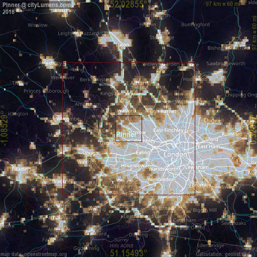
Analysis of Pinner night lights 2016
Square area 10x10 km:
 22.33%
90-99
29.68%80-89
10.96%70-79
7.49%60-69
11.9%50-59
11.76%40-49
4.95%30-39
0.8%20-29
0.13%10-19
0%0-9
0%Square area 50x50 km:
22.21%90-99
13.12%80-89
5.14%70-79
4.15%60-69
5.65%50-59
6.33%40-49
6.23%30-39
6.19%20-29
8.37%10-19
10.53%0-9
12.1%Clear (daylight) street map image can be seen on geolist.org.
Map coordinates:
52° 1' 42.8" North, 1° 5' 7" West
51° 35' 37.8" North, 0° 22' 55.8" West
51° 9' 17.7" North, 0° 19' 15.5" East
Some cities around Pinner sort by population:
• Brent
7.1 km =4.4 mi,  129°
129°
• Watford
6.9 km =4.3 mi,  352°
352°
• Ruislip
3.6 km =2.2 mi,  231°
231°
• Northolt
5.1 km =3.2 mi,  168°
168°
• Bushey
5.7 km =3.5 mi,  15°
15°
• Harrow on the Hill
4.2 km =2.6 mi, 126°
• Greenhill
3.2 km =2 mi,  111°
111°
• Harefield
7.2 km =4.5 mi,  278°
278°
2640275 (p: 19,158)
Sources (retrieved 2019-11-25):
» Earth at Night: Flat Maps 2012, 2016