Bushey night lights from space
Night Light of Bushey (England) from space (United Kingdom) Src. Average luminocity for 10x10km area is 68.7745% and for 50x50km: 53.2353%.
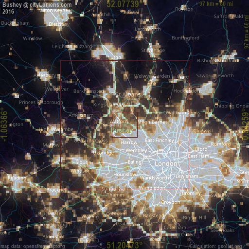
Analysis of Bushey night lights 2016
Square area 10x10 km:
 12.32%
90-99
13.31%80-89
6.72%70-79
8.96%60-69
18.49%50-59
21.57%40-49
10.22%30-39
8.4%20-29
0%10-19
0%0-9
0%Square area 50x50 km:
21.25%90-99
11.7%80-89
4.43%70-79
3.34%60-69
4.75%50-59
5.1%40-49
5.09%30-39
6.08%20-29
7.99%10-19
11.49%0-9
18.8%Clear (daylight) street map image can be seen on geolist.org.
Map coordinates:
52° 4' 38.6" North, 1° 3' 49.2" West
51° 38' 35.4" North, 0° 21' 37.9" West
51° 12' 17" North, 0° 20' 33.3" East
Some cities around Bushey sort by population:
• Watford
2.8 km =1.7 mi,  298°
298°
• Borehamwood
5.9 km =3.7 mi,  77°
77°
• Pinner
5.7 km =3.5 mi,  195°
195°
• Rickmansworth
8.1 km =5 mi,  266°
266°
• Abbots Langley
8 km =5 mi,  330°
330°
• Edgware
6.8 km =4.2 mi,  119°
119°
• Greenhill
6.8 km =4.2 mi,  167°
167°
• Radlett
5.6 km =3.5 mi,  31°
31°
2654179 (p: 17,380)
Sources (retrieved 2019-11-25):
» Earth at Night: Flat Maps 2012, 2016