Partington night lights from space
Night Light of Partington (England) from space (United Kingdom) Src. Average luminocity for 10x10km area is 46.4299% and for 50x50km: 48.8588%.
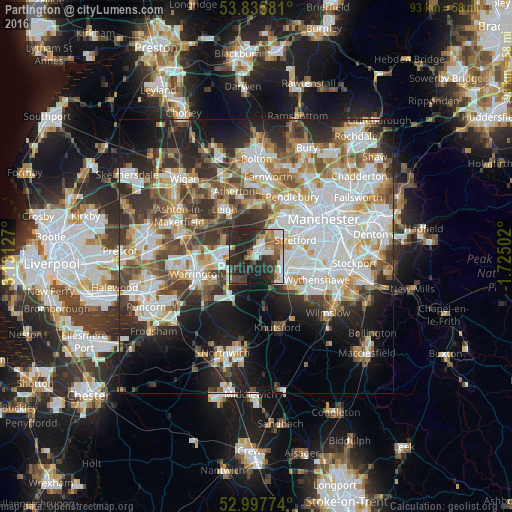
Analysis of Partington night lights 2016
Square area 10x10 km:
 8.2%
8.2%90-99
8.6%80-89
2.65%70-79
4.63%60-69
7.01%50-59
5.82%40-49
6.08%30-39
13.76%20-29
30.16%10-19
12.96%0-9
0.13%Square area 50x50 km:
13.11%90-99
11.21%80-89
4.96%70-79
5.14%60-69
5.91%50-59
5.69%40-49
6.46%30-39
6.72%20-29
10.27%10-19
12.04%0-9
18.49%Clear (daylight) street map image can be seen on geolist.org.
Map coordinates:
53° 50' 8.9" North, 3° 7' 52.6" West
53° 25' 7.8" North, 2° 25' 41.3" West
52° 59' 51.9" North, 1° 43' 30.1" West
Some cities around Partington sort by population:
• Sale
6.9 km =4.3 mi,  84°
84°
• Altrincham
6.3 km =3.9 mi,  123°
123°
• Urmston
5.9 km =3.7 mi,  56°
56°
• Irlam
2.7 km =1.7 mi,  7°
7°
• Lymm
5.3 km =3.3 mi,  217°
217°
• Timperley
6.6 km =4.1 mi,  108°
108°
• Culcheth
7.1 km =4.4 mi,  300°
300°
• Bowdon
6.3 km =3.9 mi,  138°
138°
2640593 (p: 7,895)
Sources (retrieved 2019-11-25):
» Earth at Night: Flat Maps 2012, 2016