Melton Mowbray night lights from space
Night Light of Melton Mowbray (England) from space (United Kingdom) Src. Average luminocity for 10x10km area is 9.9747% and for 50x50km: 14.9433%.
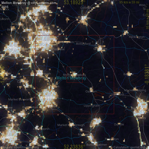
Analysis of Melton Mowbray night lights 2016
Square area 10x10 km:
 1.14%
1.14%90-99
0.88%80-89
1.64%70-79
1.14%60-69
0.88%50-59
1.89%40-49
1.89%30-39
1.64%20-29
0.76%10-19
2.02%0-9
86.11%Square area 50x50 km:
2.82%90-99
3.36%80-89
1.68%70-79
1.56%60-69
1.8%50-59
1.67%40-49
1.89%30-39
1.85%20-29
3.64%10-19
8.18%0-9
71.56%Clear (daylight) street map image can be seen on geolist.org.
Map coordinates:
53° 11' 21.3" North, 1° 35' 24.2" West
52° 45' 57.2" North, 0° 53' 12.9" West
52° 20' 18.1" North, 0° 11' 1.7" West
Some cities around Melton Mowbray sort by population:
• Mountsorrel
18.5 km =11.5 mi,  252°
252°
• Syston
15.2 km =9.4 mi,  232°
232°
• Oakham
15.1 km =9.4 mi,  136°
136°
• Sileby
15.3 km =9.5 mi,  256°
256°
• Cotgrave
18.8 km =11.7 mi,  327°
327°
• Keyworth
18 km =11.2 mi,  310°
310°
• Barrow upon Soar
17.5 km =10.9 mi, 264°
• Quorndon
19.4 km =12.1 mi, 263°
2642763 (p: 27,158)
Sources (retrieved 2019-11-25):
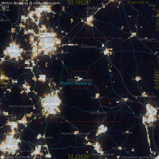
» Earth at Night: Flat Maps 2012, 2016